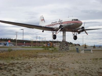
Whitehorse, Yukon — The Northern Territories (North America)
Alaska Highway
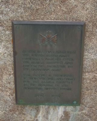
(left marker)
the United States Army
officially handed over
the Alaska Highway and
associated facilities to
the Canadian Army
This plaque is dedicated
to the those who built and cared
for the Alaska Highway
by the members of the
Northwest Highway System
June 1956
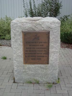
(right marker)
the Canadian Army
handed over responsibility
for the Alaska Highway and
the Northwest Highway System
to the Federal Department of
Public Works
Topics. This historical marker is listed in these topic lists: Man-Made Features • Roads & Vehicles. A significant historical date for this entry is April 1, 1946.
Location. 60° 42.718′ N, 135° 4.77′ W. Marker is in Whitehorse, Yukon. Marker can be reached from Norseman Road south of Fairchild Place. These markers are located at the Yukon Transportation Museum which is on the grounds of the Whitehorse Airport. Touch for map. Marker is at or near this postal address: 30 Electra Crescent, Whitehorse YT Y1A 6E4, Canada. Touch for directions.
Other nearby markers. At least 4 other markers are within 3 kilometers of this marker, measured as the crow flies. Log Church & Rectory (approx. 1.6 kilometers away); SS Klondike (approx. 1.7 kilometers away); White Pass and Yukon Route Railway (approx. 1.8 kilometers away); Copper Nugget (approx. 1.9 kilometers away).
Also see . . . Alaska Highway. Wikipedia (Submitted on May 29, 2011, by Barry Swackhamer of Brentwood, California.)
Credits. This page was last revised on June 16, 2016. It was originally submitted on May 29, 2011, by Barry Swackhamer of Brentwood, California. This page has been viewed 837 times since then and 20 times this year. Photos: 1, 2, 3, 4, 5. submitted on May 29, 2011, by Barry Swackhamer of Brentwood, California. • Bernard Fisher was the editor who published this page.
