Woodstock in Shenandoah County, Virginia — The American South (Mid-Atlantic)
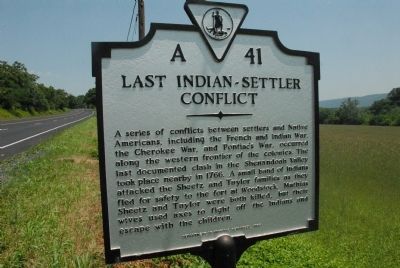
Last Indian-Settler Conflict
Erected 1995 by Department of Historic Resources. (Marker Number A-41.)
Topics and series. This historical marker is listed in these topic lists: Colonial Era • War, French and Indian • War, US Revolutionary. In addition, it is included in the Virginia Department of Historic Resources (DHR) series list. A significant historical year for this entry is 1766.
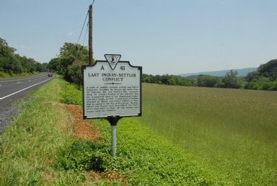
Location. 38° 50.868′ N, 78° 31.822′ W. Marker is in Woodstock, Virginia, in Shenandoah County. Marker is on Old Valley Pike (U.S. 11) 0.1 miles north of Narrow Passage Creek Bridge, on the right when traveling north. Touch for map. Marker is in this post office area: Woodstock VA 22664, United States of America. Touch for directions.
Other nearby markers. At least 8 other markers are within 3 miles of this marker, measured as the crow flies. The Stover - McGinnis House (about 600 feet away, measured in a direct line); Woodstock (approx. 2 miles away); Confederate Memorial (approx. 2.2 miles away); Welcome to Woodstock's Lovework (approx. 2.4 miles away); Reformed Church in the United States (approx. 2˝ miles away); The Original Fire Bell (approx. 2.6 miles away); Veterans Memorial Bell (approx. 2.6 miles away); Lieutenant Colonel A.S. "Sandie" Pendleton C.S.A. (approx. 2.7 miles away). Touch for a list and map of all markers in Woodstock.
Also see . . . The Last Indian Outrage. This marker replaced a 1927 marker with the same number but titled “Last Indian Outrage” erected in 1927 that read,
“Here, in 1766, took place the last Indian outrage in Shenandoah County. Five Indians attacked two settler families fleeing to Woodstock. Two men were killed; the women and children escaped.”This link is to a 2011 article by Allen Browne that discusses the marker’s revision and includes an image of the 1927 marker. (Submitted on March 4, 2022, by J. J. Prats of Powell, Ohio.)
Credits. This page was last revised on March 4, 2022. It was originally submitted on May 30, 2011, by Charles T. Harrell of Woodford, Virginia. This page has been viewed 1,533 times since then and 81 times this year. Photos: 1, 2. submitted on May 30, 2011, by Charles T. Harrell of Woodford, Virginia. • Bill Pfingsten was the editor who published this page.

