Franklin in Venango County, Pennsylvania — The American Northeast (Mid-Atlantic)
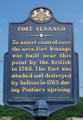
Fort Venango
Erected 1971 by Pennsylvania Historical and Museum Commission.
Topics and series. This historical marker is listed in these topic lists: Forts and Castles • Native Americans • War, French and Indian. In addition, it is included in the Pennsylvania Historical and Museum Commission series list. A significant historical year for this entry is 1760.
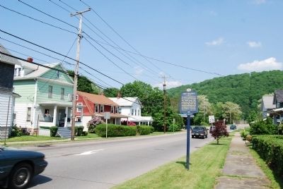
Location. 41° 23.359′ N, 79° 49.33′ W. Marker is in Franklin, Pennsylvania, in Venango County. Marker is at the intersection of 8th Street (U.S. 322) and Elk Street, on the left when traveling west on 8th Street. Touch for map. Marker is in this post office area: Franklin PA 16323, United States of America. Touch for directions.
Other nearby markers. At least 8 other markers are within walking distance of this marker. Fort Machault (a few steps from this marker); Old Garrison (approx. 0.3 miles away); Galena-Signal Oil Company (approx. 0.6 miles away); George Bissell (approx. 0.6 miles away); Venango County Vietnam Veterans Honor Roll (approx. 0.6 miles away); Venango County Civil War Monument (approx. 0.6 miles away); Venango County (approx. 0.6 miles away); World War I Veterans Memorial (approx. 0.6 miles away). Touch for a list and map of all markers in Franklin.
Also see . . . Fort Venango - Behind the Marker. ExplorePAhistory.com (Submitted on June 7, 2011, by Bernard Fisher of Richmond, Virginia.)

Photographed By N/a
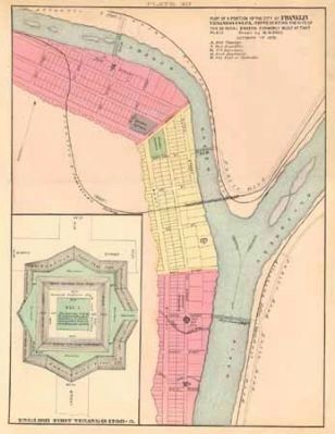
3. Fort Venango Map
This 1878 map shows the positions of Fort Venango, Fort Machault and Fort Franklin at the confluence of French Creek and the Allegheny River, at what is now the city of Franklin, Pennsylvania. Fort Venango's design is detailed in the diagram on the left.
From A History of Venango County, 1879 Courtesy the Pennsylvania Historical and Museum Commission
Credits. This page was last revised on June 16, 2016. It was originally submitted on May 31, 2011, by Mike Wintermantel of Pittsburgh, Pennsylvania. This page has been viewed 965 times since then and 43 times this year. Photos: 1, 2. submitted on May 31, 2011, by Mike Wintermantel of Pittsburgh, Pennsylvania. 3. submitted on July 28, 2011, by Mike Wintermantel of Pittsburgh, Pennsylvania. • Bernard Fisher was the editor who published this page.

