Near Harvey in Botetourt County, Virginia — The American South (Mid-Atlantic)
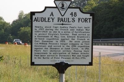
Audley Paulís Fort
Erected 1999 by Department of Historic Resources. (Marker Number A-48.)
Topics and series. This historical marker is listed in these topic lists: Colonial Era • Forts and Castles • War, French and Indian • Wars, US Indian. In addition, it is included in the Virginia Department of Historic Resources (DHR) series list. A significant historical year for this entry is 1757.
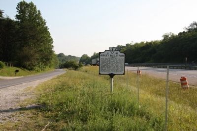
Location. 37° 36.475′ N, 79° 36.925′ W. Marker is near Harvey, Virginia, in Botetourt County. Marker is on Lee Highway (Route F055 Frontage Road) south of Plank Road (County Route 610), on the left when traveling north. Can be seen from I-81 northbound. The frontage road is former U.S. Route 11, which parallels the interstate between exits 168 and 175 (The Natural Bridge exit). Touch for map. Marker is in this post office area: Buchanan VA 24066, United States of America. Touch for directions.
Other nearby markers. At least 8 other markers are within 4 miles of this marker, measured as the crow flies. Rockbridge County / Botetourt County (approx. one mile away); Lace Waterfalls (approx. 3.8 miles away); Lost and Found (approx. 3.9 miles away); Lost River (approx. 3.9 miles away); A Cave that Armed American Soldiers (approx. 3.9 miles away); Saltpetre Cave (approx. 4 miles away); ďThe Most Sublime of Natureís WorksĒ (approx. 4 miles away); Monacan Village (approx. 4 miles away).
More about this marker. This marker replaces a previous marker erected in 1934 with the same number and title that read ďNear here stood the stockade fort of Captain Audley Paul, noted colonial frontier soldier. He served in the Sandy Creek Expedition against the Shawnees, 1786, at the Battle of Point Pleasant, 1774, and in repelling Indian raids. In 1761, the fort was crowded with settlersí families seeking protection against marauding Shawnees.Ē
Credits. This page was last revised on July 3, 2021. It was originally submitted on June 4, 2011, by J. J. Prats of Powell, Ohio. This page has been viewed 2,198 times since then and 238 times this year. Photos: 1, 2. submitted on June 4, 2011, by J. J. Prats of Powell, Ohio.

