Kansas City in Platte County, Missouri — The American Midwest (Upper Plains)
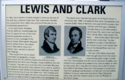
Lewis and Clark
In 1803, only a handful of states existed in America – the rest of the land was uncharted wilderness. That wilderness included the Louisiana Territory, which was purchased that year by the United States government.
At the same time, President Thomas Jefferson received approval from Congress for one of the most exciting exploration projects in history – to find a passage to the Pacific Ocean following the Missouri and Columbia Rivers. Two adventurers, Meriwether Lewis and William Clark, decided to take on the challenge.
Their assignment was to collect information on geography, climate, plant and animal life, and the people encountered as they searched for the Northwest Passage. Using a keelboat and two “pirogues,” they set out on a journey that would take 554 days to complete, during which they endured fierce storms, extreme temperatures, bear attacks and physical challenges that would test the endurance of even the fittest men. That included portaging (carrying their boats 18 miles at one point – a three-week journey up steep inclines through prickly bush and jagged rock.
The adventurers reached the sands of the Pacific Ocean in mid-November 1805. Including the trip home, the explorers had covered 8,000 miles of territory over a period of two years, four months, and nine days, including a four-day stop at a site near present-day Kansas City, now known as Clark’s Point. While there, Clark wrote in his diary, “…the country about the mouth of this river is very fine.” He also weighed the water of the Missouri and found it to be much heavier than that of the Kansas River, due to its muddy content.
The new information Lewis and Clark brought back from their adventure provided great insight into the land, the native people and the natural resources available, and helped future settlers and traders know what to expect on their journey west. But it was the information about the immensity and width of the Rocky Mountains that proved to be the most important geographical discovery. Armed with this information, explorers chose to head west over South Pass (Wyoming) rather than test their mettle trying to cross the Rockies to the Pacific Ocean.
Erected by Kansas City International Airport. (Marker Number C7.)
Topics and series. This historical marker is listed in these topic lists: Exploration • Native Americans • Patriots & Patriotism • Waterways & Vessels. In addition, it is included in the Former U.S. Presidents: #03 Thomas Jefferson, and the Lewis & Clark Expedition series lists. A significant historical year for this entry is 1803.
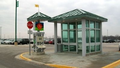
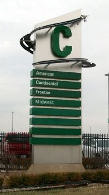
Location. 39° 19.039′ N, 94° 41.82′ W. Marker is in Kansas City, Missouri, in Platte County. Marker is at Passenger Kiosk C7, in Economy Parking Lot C, at Kansas City International Airport, 601 Brasilia Avenue. Touch for map. Marker is in this post office area: Kansas City MO 64153, United States of America. Touch for directions.
Other nearby markers. At least 8 other markers are within walking distance of this marker. On The River (about 300 feet away, measured in a direct line); Sweet Tooth (about 300 feet away); Thomas Hart Benton (about 400 feet away); All That Jazz (about 400 feet away); The Garment District (about 500 feet away); One of KC's Oldest (about 500 feet away); Swope Park (about 500 feet away); City of Fountains (about 700 feet away). Touch for a list and map of all markers in Kansas City.
More about this marker. The Economy Parking Lots' passenger kiosks each have unique historical markers and flashy artwork to help passengers remember where they parked.
Also see . . .
1. Discovering Lewis and Clark. (Submitted on June 7, 2011, by William Fischer, Jr. of Scranton, Pennsylvania.)
2. Lewis and Clark at National Geographic. (Submitted on June 7, 2011, by William Fischer, Jr. of Scranton, Pennsylvania.)
3. Lewis and Clark: A Film by Ken Burns. (Submitted on June 7, 2011, by William Fischer, Jr. of Scranton, Pennsylvania.)
4. Lewis and Clark National Historic Trail. (Submitted on June 7, 2011, by William Fischer, Jr. of Scranton, Pennsylvania.)
Credits. This page was last revised on June 5, 2022. It was originally submitted on June 7, 2011, by William Fischer, Jr. of Scranton, Pennsylvania. This page has been viewed 644 times since then and 24 times this year. Photos: 1, 2, 3, 4. submitted on June 7, 2011, by William Fischer, Jr. of Scranton, Pennsylvania.


