Near Henning in Lauderdale County, Tennessee — The American South (East South Central)
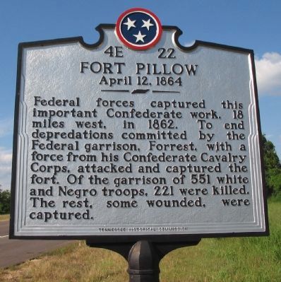
Fort Pillow
April 12, 1864
Erected by Tennessee Historical Commission. (Marker Number 4E 22.)
Topics and series. This historical marker is listed in these topic lists: African Americans • Notable Events • War, US Civil. In addition, it is included in the Battlefield Trails - Civil War, and the Tennessee Historical Commission series lists. A significant historical year for this entry is 1862.
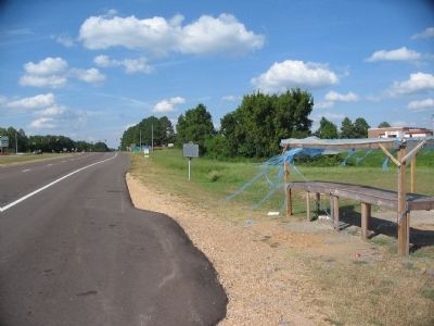
Location. 35° 40.661′ N, 89° 35.137′ W. Marker is near Henning, Tennessee, in Lauderdale County. Marker is at the intersection of Jefferson Davis Highway (U.S. 51) and Graves Street (State Highway 87), on the right when traveling north on Jefferson Davis Highway. Touch for map. Marker is in this post office area: Henning TN 38041, United States of America. Touch for directions.
Other nearby markers. At least 8 other markers are within 9 miles of this marker, measured as the crow flies. Alex Haley's Boyhood Home (approx. 0.6 miles away); Battle of Fort Pillow (approx. 1.8 miles away); Lauderdale County Courthouse (approx. 5.7 miles away); Hands Across America Mid-Point (approx. 6.6 miles away); Canaan Missionary Baptist Church History (approx. 8.4 miles away); Isaac Hayes (approx. 8˝ miles away); Hotel Lindo (approx. 8˝ miles away); Tipton County in the Civil War (approx. 8.6 miles away). Touch for a list and map of all markers in Henning.
Related markers. Click here for a list of markers that are related to this marker. Fort Pillow by Markers
Also see . . . Battle of Fort Pillow. Wikipedia entry on the battle of Fort Pillow. (Submitted on June 9, 2011, by Richard E. Miller of Oxon Hill, Maryland.)
Additional keywords. Fort Pillow Massacre; prisoners of war.
Credits. This page was last revised on June 16, 2016. It was originally submitted on October 8, 2010, by Craig Swain of Leesburg, Virginia. This page has been viewed 2,058 times since then and 75 times this year. Last updated on June 9, 2011, by Richard E. Miller of Oxon Hill, Maryland. Photos: 1, 2, 3. submitted on October 8, 2010, by Craig Swain of Leesburg, Virginia. 4. submitted on October 9, 2010, by Craig Swain of Leesburg, Virginia.


