
Mentor in Lake County, Ohio — The American Midwest (Great Lakes)
Mentor Lagoons
Photographed by William Fischer, Jr., June 9, 2011
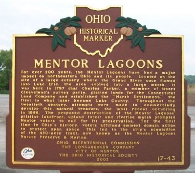
1. Mentor Lagoons Marker
For over 200 years, the Mentor Lagoons have had a major impact on northeastern Ohio and its people. Located on the site of a large estuary where the Grand River once flowed into Lake Erie, the area evolved into a large marsh. It was here in 1797 that Charles Parker, a member of Moses Cleaveland's survey party, platted lands for the Connecticut Land Company and established the "Marsh Settlement," the first in what later became Lake County. Throughout the twentieth century, attempts were made to commercially develop this natural treasure, the most recent occurring in 1996. The proposed destruction of the Mentor Lagoons' pristine lakefront, upland forest and riverine marsh prompted Mentor voters to call for its preservation. For the first time in Ohio's history, voters affirmed eminent domain action to protect open space. This led to the city's acquisition of the 450-acre tract, now known as the Mentor Lagoons Nature Preserve & Marina.
Erected 2002 by Ohio Bicentennial Commission, The Longaberger Company, City of Mentor, and The Ohio Historical Society. (Marker Number 17-43.)
Topics and series. This historical marker
this page online
Location. 41° 43.546′ N, 81° 20.332′ W. Marker is in Mentor, Ohio, in Lake County. It can be reached from Harbor Drive. Marker is near the entrance to the Mentor Lagoons Nature Preserve & Marina. Touch for map. Marker is at or near this postal address: 8365 Harbor Drive, Mentor OH 44060, United States of America. Touch for directions.

Regionally, this marker is in Greater Cleveland, on the Lake Erie Shore, and in the Western Reserve. It is also in the American Midwest. Globally, it is in North America, on the Great Lakes, in the Western Hemisphere, in the Western World, and in the Anglosphere. Historically, it finds itself in what was once the Haudenosaunee (Iroquois) Confederacy, the territory of the Mississippian Culture, and the Northwest Territory.
Other nearby markers. At least 8 other markers are within walking distance of this marker: Marsh Settlement (here, next to this marker); Mentor Lagoons Nature Preserve
Photographed by William Fischer, Jr., June 9, 2011
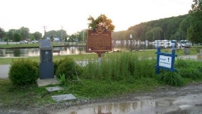
2. Mentor Lagoons Marker
Lagoon in distance
Another marker is no longer nearby. Mentor Lagoons Water Trail (was a few steps from this marker but has been permanently removed).
Also see . . . Mentor Lagoons Nature Preserve and Marina. Town website entry (Submitted on June 25, 2011, by William Fischer, Jr. of Reynoldsburg, Ohio.)
Credits. This page was last revised on June 28, 2025. It was originally submitted on June 25, 2011, by William Fischer, Jr. of Reynoldsburg, Ohio. This page has been viewed 1,645 times since then and 80 times this year. Photos: 1, 2. submitted on June 25, 2011, by William Fischer, Jr. of Reynoldsburg, Ohio.
