Laurel in Sussex County, Delaware — The American Northeast (Mid-Atlantic)
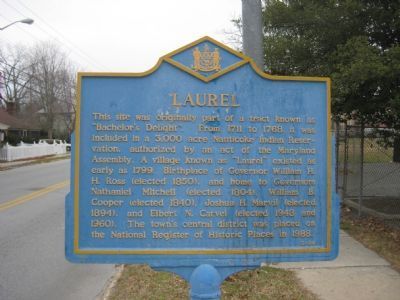
Laurel
Photographed by F. Robby, December 8, 2007
1. Laurel Marker
Topics and series. This historical marker is listed in these topic lists: Colonial Era • Government & Politics • Indigenous Peoples and Communities • Settlements & Settlers. In addition, it is included in the Delaware Public Archives, and the National Register of Historic Places (NRHP) series lists. A significant historical year for this entry is 1711.
Location. 38° 33.064′ N, 75° 34.191′ W. Marker is in Laurel, Delaware, in Sussex County. It is on Central Avenue (Alternate U.S. 13) 0.1 miles south of 8th Street, on the left
this page online

Regionally, this marker is in the American Mid-Atlantic, on the Delmarva Peninsula, and on the Eastern Seaboard. Globally, it is in the North Atlantic Region, North America, the Western Hemisphere, the Western World, and the Anglosphere. Historically, it finds itself in what was once New Netherland, one of the original Thirteen Colonies, and the Antebellum South.
Other nearby markers. At least 8 other markers are within walking distance of this marker: The Studley House (approx. 0.2 miles away); 511 Pine Street (approx. 0.2 miles away); Wooten-Truitt House (approx. ¼ mile away); Hope Lodge No. 4 (approx. ¼ mile away); 505 South Central Avenue (approx. ¼ mile away); Christ United Methodist Church (approx. ¼ mile away); Shepard House (approx. ¼ mile away); 407 5th Street (approx. ¼ mile away). Touch for a list and map of all markers in Laurel.
Also see . . . Laurel Historic District - National Register of Historic Places Nomination Form.
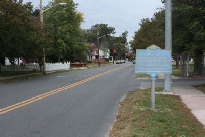
Founded in the late eighteenth century.(Submitted on April 24, 2025, by Pete Skillman of Wilmington, Delaware.)Laurel quickly developed into an important shipping and manufacturing town in Southwest Delaware. The home of a number of Delaware's governor's. Laurel exerted an influence over Delaware far greater than its size would seem to indicate. Originally oriented to the Chesapeake Bay market, when the railroad came through in the mid-nineteenth century, the market orientation shifted to Philadelphia and to the manufacture of lumber products and the shipping and canning of fruits and vegetables. The ever increasing prosperity in Laurel is reflected in its architecture. While no eighteenth-century buildings are known to survive in Laurel, the range of nineteenth-and twentieth-century architecture is most interesting. It is heavily reflective of national trends and of the prosperity of Laurel in the late nineteenth and early twentieth centuries.Photographed by Mike Stroud, October 15, 20122. Laurel Marker seen along Central Avenue (US 13A)
Photographed by F. Robby, December 8, 2007
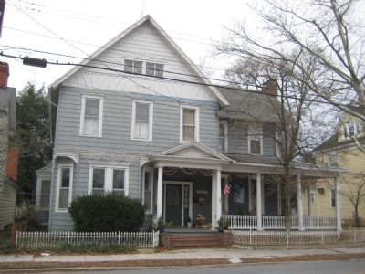
3. A Laurel Home
One of many homes in the historic district of Laurel
Photographed by F. Robby, December 8, 2007
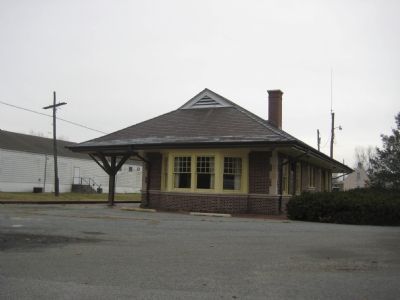
4. Laurel Train Depot
Photographed by F. Robby, December 8, 2007
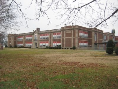
5. Laurel School
The Laurel marker is located in front of the Laurel School building, which now houses the Laurel Intermediate and Laurel Middle schools.
Credits. This page was last revised on April 24, 2025. It was originally submitted on December 30, 2007, by F. Robby of Baltimore, Maryland. This page has been viewed 2,350 times since then and 26 times this year. Photos: 1. submitted on December 30, 2007, by F. Robby of Baltimore, Maryland. 2. submitted on November 2, 2012, by Mike Stroud of Bluffton, South Carolina. 3, 4, 5. submitted on December 30, 2007, by F. Robby of Baltimore, Maryland.
