Near Big Stone Gap in Wise County, Virginia — The American South (Mid-Atlantic)
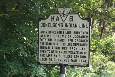
Donelsonís Indian Line
Erected 1932 by Conservation & Development Commission. (Marker Number KA-8.)
Topics and series. This historical marker is listed in these topic lists: Colonial Era • Native Americans • Settlements & Settlers. In addition, it is included in the Virginia Department of Historic Resources (DHR) series list. A significant historical year for this entry is 1770.
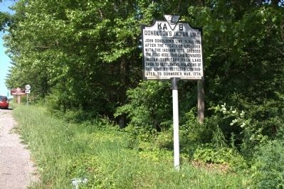
Location. 36° 48.724′ N, 82° 47.204′ W. Marker is near Big Stone Gap, Virginia, in Wise County. Marker is on Orby Cantrell Highway (U.S. 23) near the Lee-Wise County line, on the right when traveling north. Touch for map. Marker is in this post office area: Big Stone Gap VA 24219, United States of America. Touch for directions.
Other nearby markers. At least 8 other markers are within 4 miles of this marker, measured as the crow flies. Lee County / Wise County (within shouting distance of this marker); Seminary United Methodist Church (approx. 2.6 miles away); Turkey Cove (approx. 2.6 miles away); Members of Congress (approx. 3Ĺ miles away); Southwest Virginia Museum (approx. 3.6 miles away); Christ Episcopal Church (approx. 3.6 miles away); Big Stone Gap (approx. 3.8 miles away); Carl Martin (approx. 3.8 miles away). Touch for a list and map of all markers in Big Stone Gap.
More about this marker. I place this marker some 200 feet north of the county line in Wise County using Google Earth. The Virginia Department of Historic Resources database says it is in Lee county, but if you look on their map, you will find the nearby "Lee County / Wise County" marker that designates the county line just south of this marker, another indication that this marker is indeed in Wise County. It might have been in Lee County before this road was widened, but no longer.
Regarding Donelsonís Indian Line. Difficulty in agreeing over the exact location of the boundary between the Cherokee Nation and the colony of Virginia led to this settlement. The border ran from the Holston River northto convergence of the Great Kanawha and Ohio Rivers (present-day Henderson, West Virginia).
Related markers. Click here for a list of markers that are related to this marker. It lists two markers on Donelsonís Indian Line. Use the mapping feature to see both on the same map.
Also see . . . 1770 Treaty of Lochaber. A transcription of the treaty, with maps. It begins, “A Treaty for a Cession to His most Sacred Majesty George the Third by the Grace of God of Great Britain France and Ireland King defender of the faith and so forth, by the said Nation of Cherokee Indians of certain Lands lying within the Limits of the dominion of Virginia. Whereas by a Treaty Entered into and concluded at Hard Labour, the Fourteenth day of October 1768, by John Stuart Esquire His Majestyís Agent and Superintendant of the Indian Nations Inhabiting the Southern district of North America, with the principal and Ruling Chiefs of the Cherokee Nation: . . .” (Submitted on July 9, 2011, by J. J. Prats of Powell, Ohio.)
Credits. This page was last revised on June 2, 2017. It was originally submitted on July 9, 2011, by J. J. Prats of Powell, Ohio. This page has been viewed 972 times since then and 55 times this year. Photos: 1, 2. submitted on July 9, 2011, by J. J. Prats of Powell, Ohio.

