Tree Park in Chattanooga in Hamilton County, Tennessee — The American South (East South Central)
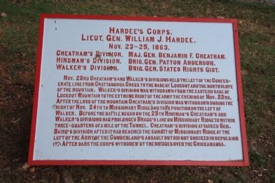
Hardee's Corps
Lieut. Gen. William J. Hardee.
| — | Nov. 23 - 25, 1863. | — |
Photographed by Dale K. Benington, June 7, 2011
1. Hardee's Corps Marker
Hindman's Division, Brig. Gen. Patton Anderson.
Walker's Division, Brig. Gen. States Rights Gist.
Nov. 23ed Cheatham's and Walker's divisions held the left of the Confederate line from Chattanooga Creek to the base of Lookout and the north slope of the mountain. Walker's division was withdrawn from the eastern base of Lookout Mountain to the extreme right of the army the evening of Nov. 23rd. After the loss of the mountain Cheatham's division was withdrawn during the night of Nov. 24th to Missionary Ridge and took position on the left of Walker. Before the battle began on the 25th Hindman's Cheatham's and Walker's divisions had prolonged Bragg's line on Missionary Ridge to within three-quarters of a mile of the Tunnel. Cheatham's division attacked Gen. Baird's division after it had reached the summit of Missionary Ridge at the left of the Army of the Cumberland's assault but did not succeed in repulsing it. After dark the corps withdrew by the bridges over the Chickamauga.
Erected 1890 by Chickamauga-Chattanooga National Battlefield Commission. (Marker Number
this page online
Topics and series. This historical marker is listed in this topic list: War, US Civil. In addition, it is included in the Chickamauga and Chattanooga National Military Park, Sherman Reservation, and the Chickamauga and Chattanooga National Military Park: November 25, 1863 series lists. A significant historical month for this entry is October 1775.
Location. 35° 3.946′ N, 85° 14.435′ W. Marker is in Chattanooga, Tennessee, in Hamilton County. It is in Tree Park. It is at the intersection of North Crest Road and Lightfoot Mill Road, on the right when traveling north on North Crest Road. This historical marker is located at the entrance to the Sherman Reservation, which in turn is located near where North Crest Road comes to an end. Touch for map. Marker is in this post office area: Chattanooga TN 37406, United States of America. Touch for directions.

Regionally, this marker is in the American South, specifically in the Upper South, in Appalachia, and specifically in Southern Appalachia. Globally, it is in North America, the Western Hemisphere, the Western World, and the Anglosphere. Historically, it finds itself in what was once
Photographed by Dale K. Benington, June 7, 2011
2. Hardee's Corps Marker
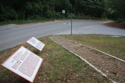
View looking south of the historical marker situated along the footpath leading from the nearby street intersection to the entrance to the Sherman Reservation.
Other nearby markers. At least 8 other markers are within walking distance of this marker: Douglas' (Texas) Battery (here, next to this marker); Barret's Missouri Battery (here, next to this marker); Barrett's C.S.A. Missouri Battery (a few steps from this marker); Howell's Georgia Battery (within shouting distance of this marker); Brown's Brigade. (about 300 feet away, measured in a direct line); Calvert's (Arkansas) Battery (about 300 feet away); 90th Illinois Infantry (approx. 0.2 miles away); 26th Illinois Infantry (approx. 0.2 miles away). Touch for a list and map of all markers in Chattanooga.
Related markers. Click here for a list of markers that are related to this marker. Use this link to see the Division tablets for this Army Corps.
Photographed by Dale K. Benington, June 7, 2011
3. Hardee's Corps Marker
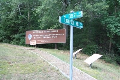
View of the historical marker looking north of the street intersection along the pathway leading to the Sherman Reservation.
Photographed by Dale K. Benington, June 7, 2011
4. Sherman Reservation Sign
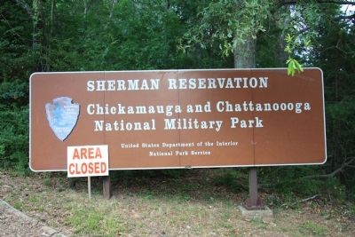
During my visit to photograph some of the Civil War markers in the Chattanooga area, the Sherman Reservation was closed due to the large number of fallen trees from the April 27th storm.
Credits. This page was last revised on February 7, 2023. It was originally submitted on July 10, 2011, by Dale K. Benington of Toledo, Ohio. This page has been viewed 1,016 times since then and 25 times this year. Photos: 1, 2, 3, 4. submitted on July 10, 2011, by Dale K. Benington of Toledo, Ohio.
