Near Brimley in Chippewa County, Michigan — The American Midwest (Great Lakes)
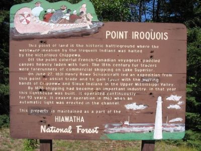
Point Iroquois
Photographed by Keith L, August 10, 2006
1. Point Iroquois Marker
Off the point colorful French-Canadian voyageurs paddled canoes heavily laden with furs. The 18th century fur traders were forerunners of commercial shipping on Lake Superior.
On June 27, 1831 Henry Rowe Schoolcraft led an expedition from this point to assist trade and to gain favor with the warring bands of Chippewa and Sioux Indians in the Upper Mississippi Valley.
By 1870 shipping had become an important industry. In that year this lighthouse was built. It operated continuously for 93 years. It ceased operation in 1963 when an automatic light was erected in the channel.
This property is maintained as a part of the Hiawatha National Forest.
Topics and series. This historical marker is listed in these topic lists: Exploration • Industry & Commerce • Landmarks • Wars, US Indian • Waterways & Vessels. In addition, it is included in the Lighthouses series list. A significant historical month for this entry is June 2004.
Location. 46° 29.028′ N, 84° 37.896′ W. Marker
this page online

Regionally, this marker is on Michigan’s Upper Peninsula. It is also in the American Midwest and on Lake Superior’s South Shore Region. Globally, it is in North America, in the Great North Woods, on the Great Lakes, in the Western Hemisphere, in the Western World, and in the Anglosphere. Historically, it finds itself in what was once the Viceroyalty of New France and also the Northwest Territory.
Other nearby markers. At least 5 other markers are within walking distance of this marker: Point Iroquois Light Station (a few steps from this marker); Place of the Iroquois Bones (within shouting distance of this marker); Anishinabeg (within shouting distance of this marker); Glacial Gifts (within shouting distance of this marker); Tower View (about 300 feet away, measured in a direct line).
More about this marker.
Photographed by Keith L, August 10, 2006
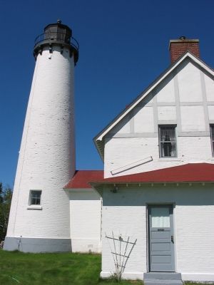
2. Point Iroquois Lighthouse
Regarding Point Iroquois. In 1662 a group of Iroquois traveled about 400 miles by canoe and foot from their homeland in western New York to the shores of Lake Superior. The Iroquois war party camped near the point where the lighthouse now stands; the Chippewa secretly watched their movements and mounted a surprise attack near dawn.
Also see . . .
1. Point Iroquois Lighthouse. "This lighthouse stands watch where Lake Superior begins its treacherous rush into the St. Mary's River." (Submitted on January 1, 2008.)
2. Point Iroquois Light. "A prefabricated cast iron spiral stairway with 72 steps wound within the tower, supported by a hollow central iron column. Capped with a decagonal cast iron lantern housing the Fourth Order Fresnel from the original tower, exhibiting the station's characteristic white flash every 30 seconds." (Submitted on January 1, 2008.)
Photographed by Keith L, August 10, 2006
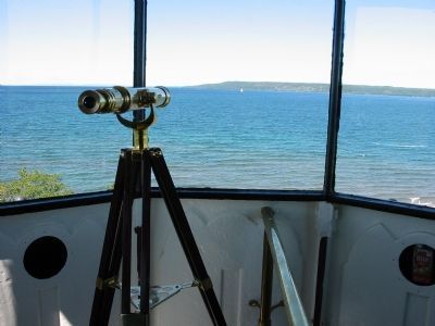
3. View of Canada from Lantern Deck
Photographed by Duane Hall, May 26, 2010
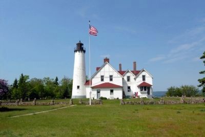
4. Point Iroquois Lighthouse
Credits. This page was last revised on June 16, 2016. It was originally submitted on January 1, 2008, by Keith L of Wisconsin Rapids, Wisconsin. This page has been viewed 2,611 times since then and 51 times this year. Photos: 1, 2, 3. submitted on January 1, 2008, by Keith L of Wisconsin Rapids, Wisconsin. 4. submitted on January 14, 2014, by Duane Hall of Abilene, Texas. • J. J. Prats was the editor who published this page.
