
Near Paradise in Luce County, Michigan — The American Midwest (Great Lakes)
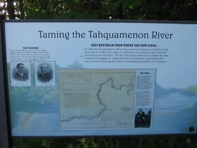
Taming the Tahquamenon River
Photographed by Keith L, August 10, 2006
1. Taming the Tahquamen River Marker
James McMillan (left) and John S. Newberry (right) founded the Detroit, Mackinac & Marquette Railroad (DM&M). After completing the railroad, the company sought ways to develop the properties that they owned along the route. On October 6, 1880 the DM&M created the Tahquamenon River Improvement Company.
Just upstream from where you now stand......
In 1883, the Tahquamenon River Improvement Company completed the removal of 16,000 cubic yards of sandstone, including a small waterfall from the bed of the river. The $41,000 project was done to make the river suitable for navigation, ready the river for log drives, and deepen the river to drain thirty square miles of swampland owned by the company.
The Plan
Daniel Farrand Henry (below) surveyed the Tahquamenon River in 1880 for the Detroit, Mackinac, & Marquette Railroad Company. His report and map (left) detail the work necessary to "improve" the river.
The "Detail of Proposed Improvement" in the upper left corner of the map, states that "The improvement proposed is to cut away the crest of the "dam" at the upper rapids which would lower the water (table
this page online
Topics. This historical marker is listed in these topic lists: Natural Features • Railroads & Streetcars • Waterways & Vessels. A significant historical date for this entry is October 6, 1880.
Location. 46° 34.524′ N, 85° 15.324′ W. Marker is near Paradise, Michigan, in Luce County. It can be reached from State Highway 123, on the left when traveling south. Marker is west of Paradise, north of Newberry. Touch for map. Marker is at or near this postal address: 41382 West M 123, Paradise MI 49768, United States of America. Touch for directions.

Regionally, this marker is on Michigan’s Upper Peninsula. It is also in the American Midwest, on the Great Lakes, and on Lake Superior’s South Shore Region. Globally, it is in North America, the Great North Woods, the Western Hemisphere, the Western World, and the Anglosphere. Historically, it finds itself in what was once the Northwest Territory.
Other nearby markers. At least one other marker is within 12 miles of this marker, measured as the crow flies: Life Saving Station (approx. 11.6 miles away).
More about this marker. Marker is in
Photographed by Keith L, August 10, 2006
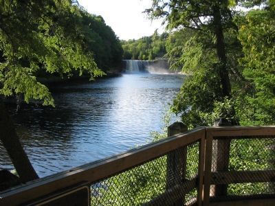
2. Tahquamenon River and Upper Falls
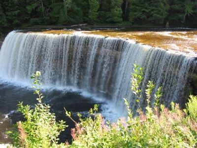
Regarding Taming the Tahquamenon River. The park's Upper Falls is the second largest waterfall east of the Mississippi. At more than 200 feet wide and nearly 50 feet of vertical drop, the only larger falls in the eastern U.S. is Niagara.
Photographed by Keith L, August 10, 2006
3. Upper Falls
Photographed by Keith L, August 10, 2006
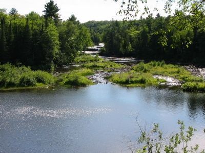
4. Tahquamenon River and Lower Falls
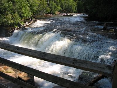
Photographed by Keith L, August 10, 2006
5. Lower Falls
Credits. This page was last revised on November 27, 2024. It was originally submitted on January 1, 2008, by Keith L of Wisconsin Rapids, Wisconsin. This page has been viewed 2,479 times since then and 30 times this year. Photos: 1, 2, 3, 4, 5. submitted on January 1, 2008, by Keith L of Wisconsin Rapids, Wisconsin. • J. J. Prats was the editor who published this page.
