Missionary Ridge in Chattanooga in Hamilton County, Tennessee — The American South (East South Central)
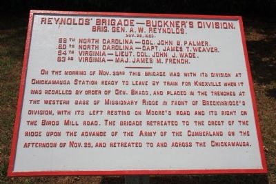
Reynolds' Brigade
Buckner's Division.
— Brig. Gen. A. W. Reynolds. —
Brig. Gen. A. W. Reynolds.
Nov. 25, 1863.
58th North Carolina - Col. John B. Palmer.
60th North Carolina - Capt. James T. Weaver.
54th Virginia - Lieut. Col. John J. Wade
63rd Virginia - Maj.James M. French.
———————
On the morning of Nov. 23rd this brigade was with its division at Chickamauga Station ready to leave by train for Knoxville when it was recalled by order of Gen. Bragg, and placed in the trenches at the western base of Missionary Ridge in front of Breckinridge's Division, with its left resting on Moore's Road and its right on the Birds Mill road. The brigade retreated to the crest of the ridge upon the advance of the Army of the Cumberland on the afternoon of Nov. 25, and retreated to and across the Chickamauga.
Erected 1890 by the Chickamauga-Chattanooga National Battlefield Commission. (Marker Number MT-386.)
Topics and series. This historical marker is listed in this topic list: War, US Civil. In addition, it is included in the Chickamauga and Chattanooga National Military Park, Missionary Ridge, and the Chickamauga and Chattanooga National Military Park: November 25, 1863 series lists. A significant historical date for this entry is October 25, 1863.
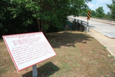
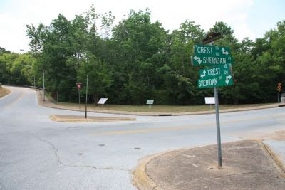
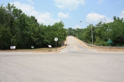
Location. 35° 1.231′ N, 85° 15.706′ W. Marker is in Chattanooga, Tennessee, in Hamilton County. It is in Missionary Ridge. Marker is at the intersection of North Crest Road and Sheridan Avenue, on the right when traveling south on North Crest Road. In order to view this historical marker one must find a way to get to the crest of Missionary Ridge. The options to use in ascending Missionary Ridge are limited and difficult to locate if you are not familiar with the area. From downtown Chattanooga, I drove east to Missionary Ridge on Main Street, and using Main Street took me to the top of Missionary Ridge. Once at the top of Missionary Ridge I needed to make two right turns to get to the intersection of South Crest Road and Sheridan Avenue which is where this historical marker is located. This intersection is just south of the South Crest Road bridge over Interstate 24, on the top of Missionary Ridge. Touch for map. Marker is in this post office area: Chattanooga TN 37404, United States of America. Touch for directions.
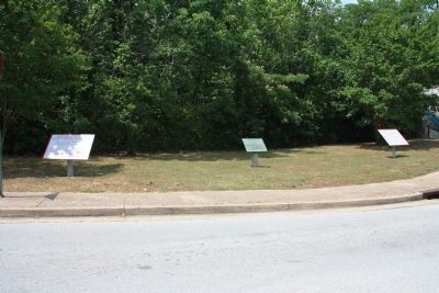
Other nearby markers. At least 8 other markers are within walking distance of this marker. 97th Ohio Infantry (here, next to this marker); Massenburg's Georgia Battery (a few steps from this marker); 64th Ohio Infantry (about 300 feet away, measured
in a direct line); Havis' Georgia Battery (about 300 feet away); 65th Ohio Infantry. (about 400 feet away); 22nd Illinois Infantry (about 400 feet away); 125th Ohio Infantry (about 400 feet away); a different marker also named 97th Ohio Infantry (about 400 feet away). Touch for a list and map of all markers in Chattanooga.
Photographed By Dale K. Benington, June 7, 2011
4. Reynolds' Brigade - Buckner's Division Marker
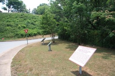
Close-up view of the historical marker situated on the far right of a group of three historical markers, with a background view of South Crest Road continuing along the western crest of Missionary Ridge and a distant view of the Illinois Memorial Monument at the top of the hill in the Bragg Reservation.
Credits. This page was last revised on February 7, 2023. It was originally submitted on July 12, 2011, by Dale K. Benington of Toledo, Ohio. This page has been viewed 508 times since then and 15 times this year. Photos: 1, 2, 3, 4, 5, 6. submitted on July 12, 2011, by Dale K. Benington of Toledo, Ohio.
