Mandan in Morton County, North Dakota — The American Midwest (Upper Plains)
Mandan Scenic Overlook
Lewis & Clark in North Dakota
Photographed by Beverly Pfingsten, June 5, 2011
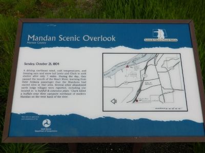
1. Mandan Scenic Overlook Marker
Sunday, October 21, 1804
A driving northeast wind, cold temperatures, and freezing rain and snow led Lewis and Clark to seek shelter after only 7 miles. During the day, they passed the mouth of the Heart River learning from their Arikara passenger that the Mandans had sacred sites in that area. Several other abandoned earth lodge villages were reported, including one located in "a butifull & extensive plain." Clark killed a buffalo near their campsite northeast of modern Mandan on the west bank of the river.
Erected by North Dakota Department of Transportation.
Topics and series. This historical marker is listed in these topic lists: Exploration • Indigenous Peoples and Communities • Religion & Religious Structures • Waterways & Vessels. In addition, it is included in the Lewis & Clark Expedition series list. A significant historical date for this entry is October 21, 1804.
Location. 46° 50.909′ N, 100° 55.062′ W. Marker is in Mandan, North Dakota, in Morton County. It is on Interstate 94 0.2 miles west of Sunset Drive Exit, on the right when traveling east. Touch for map. Marker is in this post office area: Mandan
this page online

Regionally, this marker is on the Missouri Plateau and in Greater Bismarck Area. It is also in the American Lewis & Clark Corridor, on the prairies, and on the Northern Plains. Globally, it is in North America, the Western Hemisphere, the Western World, and the Anglosphere. Historically, it finds itself in what was once Rupert’s Land and also the Louisiana Purchase.
Other nearby markers. At least 8 other markers are within 6 miles of this marker, measured as the crow flies: Lewis & Clark near Bismarck-Mandan (approx. 4.6 miles away); Lewis & Clark and the Mandan Villages (approx. 4.6 miles away); Bismarck River Warehouse (approx. 5.1 miles away); Missouri River Resources (approx. 6 miles away); Geophysical Prospecting in Archaeology (approx. 6 miles away); a different marker also named Geophysical Prospecting in Archaeology (approx. 6 miles away); Early Maps Illustrating Double Ditch (approx. 6 miles away); Double Ditch State Historic Site (approx. 6 miles away).
Photographed by Beverly Pfingsten, June 5, 2011
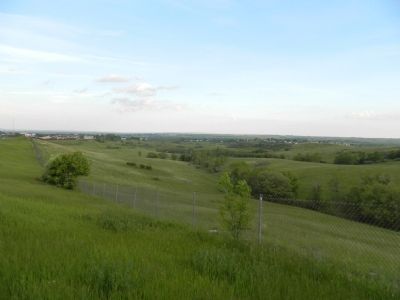
2. View from Mandan Scenic Overlook
Credits. This page was last revised on February 14, 2026. It was originally submitted on July 18, 2011, by Bill Pfingsten of Bel Air, Maryland. This page has been viewed 1,407 times since then and 38 times this year. Photos: 1, 2. submitted on July 18, 2011, by Bill Pfingsten of Bel Air, Maryland.
