Near Reads Landing in Wabasha County, Minnesota — The American Midwest (Upper Plains)
Lake Pepin
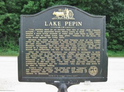
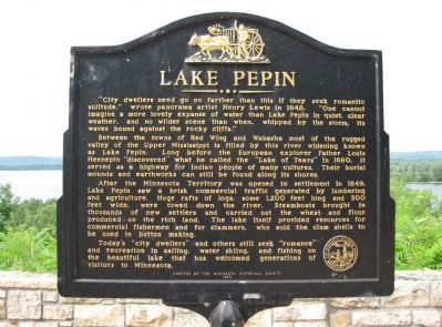
Between the towns of Red Wing and Wabasha most of the rugged valley of the Upper Mississippi is filled by this river widening known as Lake Pepin. Long before the European explorer Father Louis Hennepin “discovered” what he called the “Lake of Tears” in 1680, it served as a highway for Indian people of many cultures. Their burial mounds and earthworks can still be found along its shores.
After the Minnesota Territory was opened to settlement in 1849, Lake Pepin saw a brisk commercial traffic generated by lumbering and agriculture. Huge rafts of logs, some 1,200 feet long and 300 feet wide, were towed down the river. Steamboats brought in thousands of new settlers and carried out the wheat and flour produced on the rich land. The lake itself provided resources for commercial fishermen and for clammers, who sold the clam shells to be used in button making.
Today’s “city dwellers” and others still seek “romance” and recreation in sailing, water skiing, and fishing on the beautiful lake that has welcomed generations of visitors to Minnesota.
Erected by the Minnesota Historical Society
1985
Erected 1985 by the Minnesota Historical Society.
Topics and series. This historical marker is listed in these topic lists: Industry & Commerce • Native Americans • Settlements & Settlers • Waterways & Vessels. In addition, it is included in the Minnesota Historical Society series list. A significant historical year for this entry is 1848.
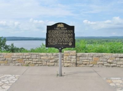
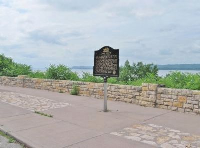
Location. 44° 24.608′ N, 92° 6.444′ W. Marker is near Reads Landing, Minnesota, in Wabasha County. Marker is on Great River Road (U.S. 61) 1˝ miles north of 9th Avenue, on the right when traveling north. Marker is along the roadside at the Reads Landing/Lake Pepin Scenic Overlook. Touch for map. Marker is in this post office area: Reads Landing MN 55968, United States of America. Touch for directions.
Other nearby markers. At least 8 other markers are within 5 miles of this marker, measured as the crow flies. The River of Rafts (a few steps from this marker); a different marker also named Lake Pepin (within shouting distance of this marker); Anchor from the "Phil Scheckel" (approx. 3.2 miles away in Wisconsin); Laura Ingalls Wilder (approx. 3.2 miles
away in Wisconsin); The Bridge (approx. 4 miles away); Wapahasha I / Wapahasha II / Wapahasha III (approx. 4.2 miles away); Veterans Memorial (approx. 4.2 miles away); Grace Memorial Episcopal Church (approx. 4.2 miles away). Touch for a list and map of all markers in Reads Landing.
Also see . . .
1. Lake Pepin. Wikipedia entry. "Lake Pepin is a naturally occurring lake, and the widest naturally occurring part of the Mississippi River... [it is] the largest lake on the entire Mississippi River." (Submitted on July 31, 2011.)
2. Minnesota Department of Transportation. Historic Roadside Development Structures Inventory. "The Reads Landing Overlook was built in 1939-1940 by the Minnesota Highway Department in cooperation with the National Youth Administration." (Submitted on July 31, 2011.)
Credits. This page was last revised on June 16, 2016. It was originally submitted on July 31, 2011, by Keith L of Wisconsin Rapids, Wisconsin. This page has been viewed 919 times since then and 40 times this year. Photos: 1, 2, 3, 4. submitted on July 31, 2011, by Keith L of Wisconsin Rapids, Wisconsin.


