Near Elm Creek in Phelps County, Nebraska — The American Midwest (Upper Plains)
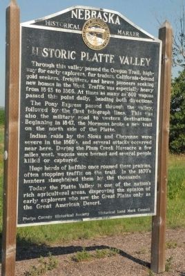
Historic Platte Valley
Photographed by Charles T. Harrell, June 29, 2011
1. Historic Platte Valley Marker
Indian raids by the Sioux and Cheyenne were severe in the 1860’s, and several attacks occurred near here. During the Plum Creek Massacre a few miles west, wagons were burned and several people killed or captured.
Huge herds of buffalo once roamed these prairies, often stopping traffic on the trail. In the 1870’s hunters slaughtered them by the thousands. Today the Platte Valley is one of the nation’s rich agricultural areas, disproving the opinion of early explorers who saw the Great Plains only as the Great American Desert.
Erected by Phelps County Historical Society, Historical Land Mark Council. (Marker Number 91.)
Topics and series. This historical marker is listed in these topic lists: Agriculture • Exploration • Roads & Vehicles. In addition, it is included in the Nebraska State Historical Society series list. A significant historical year for this entry is 1843.
Location. 40° 38.892′ N, 99° 22.823′ W. Marker is near Elm Creek, Nebraska, in Phelps County. It is on U.S. 183 0.3 miles south of Interstate 80, on the left when traveling south. Touch for map. Marker is in this post office area: Elm Creek NE 68836, United States of America. Touch for directions.

Regionally, this marker is in Eastern Nebraska. It is also in the American Midwest, in the Corn Belt, and
this page online
Other nearby markers. At least 6 other markers are within 18 miles of this marker, measured as the crow flies: 1860 (a few steps from this marker); The Tobin Indian Raid (approx. 8.7 miles away); Holdrege Silt Loam - The Nebraska State Soil (approx. 12.9 miles away); First Site of Bethel Lutheran Church and Cemetery (approx. 14½ miles away); Funk, Nebraska (approx. 14.6 miles away); Salem Swedish Methodist Episcopal Church (approx. 17.1 miles away).
Photographed by Charles T. Harrell, June 29, 2011
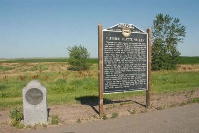
2. Historic Platte Valley Marker along with Pony Express Memorial Stone
Photographed by Charles T. Harrell, June 29, 2011
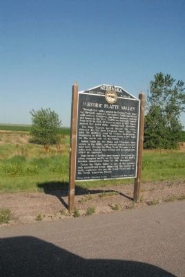
3. Historic Platte Valley Marker
Credits. This page was last revised on May 1, 2024. It was originally submitted on August 4, 2011, by Charles T. Harrell of Woodford, Virginia. This page has been viewed 1,517 times since then and 68 times this year. Photos: 1, 2, 3. submitted on August 4, 2011, by Charles T. Harrell of Woodford, Virginia. • Bill Pfingsten was the editor who published this page.
