Natchez in Adams County, Mississippi — The American South (East South Central)
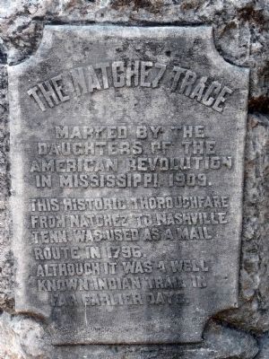
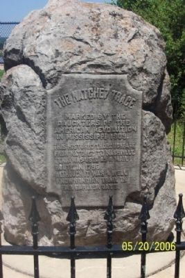
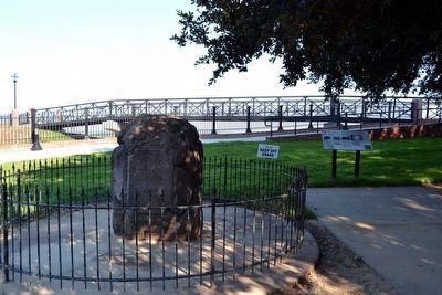
The Natchez Trace
Marked by the Daughters of the American Revolution in Mississippi 1909.
This historic thoroughfare from Natchez to Nashville, Tenn. was used as a mail route in 1796.
Although it was a well known Indian trail in far earlier days.
Erected 1909 by Daughters of the American Revolution.
Topics and series. This historical marker is listed in these topic lists: Native Americans • Roads & Vehicles. In addition, it is included in the Daughters of the American Revolution, and the Natchez Trace series lists. A significant historical year for this entry is 1909.
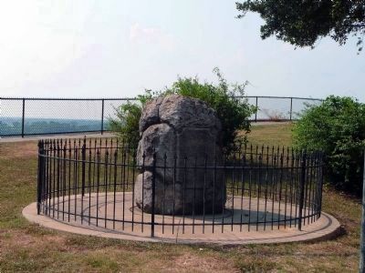
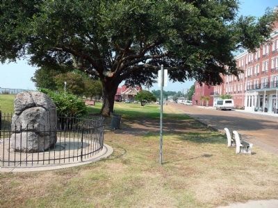
Location. 31° 33.741′ N, 91° 24.363′ W. Marker is in Natchez, Mississippi, in Adams County. Marker is on N. Broadway Street, on the left when traveling north. Marker is located in Bluff Park. Touch for map. Marker is in this post office area: Natchez MS 39120, United States of America. Touch for directions.
Other nearby markers. At least 8 other markers are within walking distance of this marker. Bluff Park and South Broadway Street (here, next to this marker); Ealey Brothers (within shouting distance of this marker); Spanish Colonial Natchez (within shouting distance of this marker); Bluff Park - Playground for the City (within shouting distance of this marker); Bluff Park and North Broadway Street (about 300 feet away, measured in a direct line); Natchez (about 300 feet away); Richard N. Wright (about 300 feet away); Bluff Park - Memorials and Louisiana Connections (about 400 feet away). Touch for a list and map of all markers in Natchez.
Regarding The Natchez Trace. Meriwether Lewis, of the Lewis and Clark Expedition, was governor of the Upper Louisiana Territory when he mysteriously died on the Natchez Trace in 1809, at Grinder's Stand in Tennessee. A monument was erected in his honor in 1848 and can be seen along the Natchez Trace Parkway today.
Also see . . .
1. Natchez Trace Parkway. Byways website entry:
Native Americans, Kaintuck boatmen, post riders, government officials and soldiers all moved across this trail, creating a vital link between the Mississippi Territory and the fledgling United States. Pass through forests, cypress swamps and farmland to meander through the rock-studded hills of Tennessee, cotton fields in Alabama, and Mississippi's marshes. (Submitted on January 6, 2008, by Kevin W. of Stafford, Virginia.)
2. Explore the Natchez Trace. Natchez Trace Parkway website entry:
Take an unforgettable road trip along this 444-mile National Scenic Byway and All-American Road that stretches from the Mississippi River in Natchez through the Shoals area in Alabama and across the Tennessee Valley to Nashville. (Submitted on January 6, 2008, by Kevin W. of Stafford, Virginia.)
3. Natchez Trace National Scenic Trail. National Park Service website entry:
The Old Natchez Trace was a 500-mile footpath that ran through Choctaw and Chickasaw lands connecting Natchez, Mississippi, to Nashville, Tennessee. You can experience portions of that journey the way earlier travelers did - on foot. (Submitted on January 6, 2008, by Kevin W. of Stafford, Virginia.)
Credits. This page was last revised on January 8, 2022. It was originally submitted on January 6, 2008, by Kevin W. of Stafford, Virginia. This page has been viewed 3,317 times since then and 67 times this year. Photos: 1. submitted on August 8, 2008, by Karen Key of Sacramento, California. 2. submitted on January 6, 2008, by Kevin W. of Stafford, Virginia. 3, 4. submitted on August 8, 2008, by Karen Key of Sacramento, California. 5. submitted on August 14, 2015, by Duane Hall of Abilene, Texas.
