Missionary Ridge in Chattanooga in Hamilton County, Tennessee — The American South (East South Central)
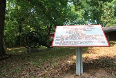
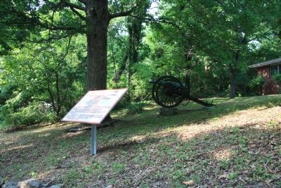
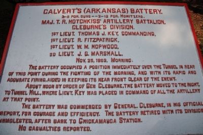
Calvert's (Arkansas) Battery
Maj. T.R. Hotchkiss' Artillery Battalion.
— Cleburne's Division —
Photographed By Dale K. Benington, June 7, 2011
1. Calvert's (Arkansas) Battery Marker
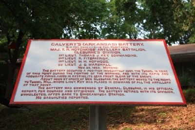
Extreme close-up view of the historical marker. Because of the historical marker being situated on top of, and close to the front of, a stone wall embankment, it was difficult to get enough space for a good photo of the front text on the historical marker.
2-6 pdr. guns -- 2-12 pdr. Howitzers.
Maj. T.R. Hotchkiss' Artillery Battalion.
Cleburne's Division
1st Lieut. Thomas J. Key, Commanding,
1st Lieut. R. Fitzpatrick,
1st Lieut. W. M. Hopwood,
2d Lieut. J. G. Marshall.
Nov. 25, 1863, Morning
About noon by order of Gen. Cleburne, the battery moved to the right, to Tunnel Hill, where Lieut. Key was placed in command of all the artillery at that point.
The battery was commended by General Cleburne, in his official report, for courage and efficiency. The battery retired with its division, unmolested, after dark to Chickamauga Station.
No casualties reported.
Erected 1890 by the Chickamauga-Chattanooga National Battlefield Commission. (Marker Number MT-400.)
Topics and series. This historical marker is listed in this topic list: War, US Civil. In addition, it is included in the Chickamauga and Chattanooga National Military Park, Missionary Ridge , and the Chickamauga and Chattanooga National Military Park: November 25, 1863 series lists. A significant historical date for this entry is October 25, 1703.
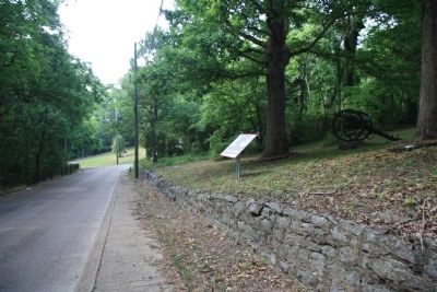
Location. 35° 3.902′ N, 85° 14.455′ W. Marker is in Chattanooga, Tennessee, in Hamilton County. It is in Missionary Ridge. Marker is on North Crest Road south of Lightfoot Mill Road, on the right when traveling north. This historical marker is located just a short distance south of the intersection with Lightfoot Mill Road, on the east side of the roadway, above an old stone wall embankment. Touch for map. Marker is at or near this postal address: 712 North Crest Road, Chattanooga TN 37406, United States of America. Touch for directions.
Other nearby markers. At least 8 other markers are within walking distance of this marker. Howell's Georgia Battery (within shouting distance of this marker); Douglas' (Texas) Battery (about 300 feet away, measured in a direct line); Hardee's Corps (about 300 feet away); Barret's Missouri Battery (about 300 feet away); Barrett's C.S.A. Missouri Battery (about 300 feet away); Brown's Brigade. (about 500 feet away); Stevenson's Division (about 700 feet away); Cumming's Brigade (approx. 0.2 miles away). Touch for a list and map of all markers in Chattanooga.
More about this marker. The historical marker is located just south of the Sherman Reservation and just to the east of where the railroad
tracks (that cannot be seen from the marker or the roadway) enter the tunnel that goes through the ridge and under both North Crest Road and this historical marker.
Credits. This page was last revised on February 7, 2023. It was originally submitted on August 6, 2011, by Dale K. Benington of Toledo, Ohio. This page has been viewed 544 times since then and 15 times this year. Photos: 1, 2, 3, 4, 5. submitted on August 6, 2011, by Dale K. Benington of Toledo, Ohio.
