Near Watrous in Mora County, New Mexico — The American Mountains (Southwest)
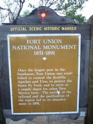
Fort Union National Monument 1851-1891
⎯⎯⎯
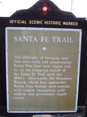
Santa Fe Trail
Photographed by Bill Kirchner, July 23, 2011
1. Fort Union National Monument Marker
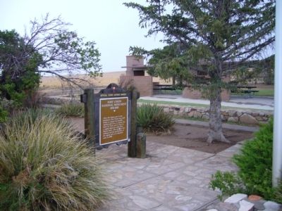
Fort Union National Monument 1851-1891. Once the largest post in the Southwest, Fort Union was established to control the Jicarilla Apaches and Utes, to protect the Santa Fe Trail, and to serve as a supply depot for other New Mexico forts. The arrival of the railroad and the pacification of the region led to its abandonment in 1891.
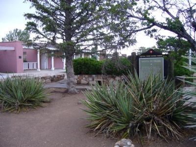
Santa Fe Trail. The difficulty of bringing caravans over rocky and mountainous Raton Pass kept most wagon traffic on the Cimarron Cutoff of the Santa Fe Trail until the 1840's. Afterwards, the Mountain Branch, which here approaches Raton Pass, became more popular with traders, immigrants, gold seekers, and government supply trains.
Erected by New Mexico Historic Preservation Division.
Topics and series. This historical marker is listed in these topic lists: Forts and Castles • Roads & Vehicles • Wars, US Indian. In addition, it is included in the Daughters of the American Revolution (DAR), and the Santa Fe Trail series lists. A significant historical year for this entry is 1891.
Location. 35° 52.67′ N, 104° 51.545′ W. Marker is near Watrous, New Mexico, in Mora County. It can
this page online

Regionally, this marker is in Northern New Mexico. It is also in the American Southwest, in the Mountain West, and on the Santa Fe Trail Corridor. Globally, it is in North America, the Rocky Mountains, the Western Hemisphere, the Western World, and the Anglosphere. Historically, it finds itself in what was once New Spain, the Dust Bowl, and the Republic of Texas.
Other nearby markers. At least 8 other markers are within 9 miles of this marker, measured as the crow flies: Santa Fe Trail (approx. 1.4 miles away); a different marker also named Santa Fe Trail (approx. 1.4 miles away); A Show of Strength (approx. 8.3 miles away); Tides of Change (approx. 8.3 miles away); Intersection of History (approx. 8.3 miles away); Lasting View (approx. 8.3 miles away); A New Community Sprouts Roots (approx. 8.3 miles away); From Indigenous Trail to International Highway (approx. 8.3 miles away).
Photographed by Bill Kirchner, July 23, 2011
2. Santa Fe Trail Marker
Also see . . . Loma Parda. Loma Parda was the closest town to Fort Union. This youtube video tells it's story through beautiful photography. (Submitted on November 28, 2011.)
Photographed by Bill Kirchner, July 23, 2011
3. Fort Union National Monument Marker
Photographed by Bill Kirchner, July 23, 2011
4. Santa Fe Trail Marker
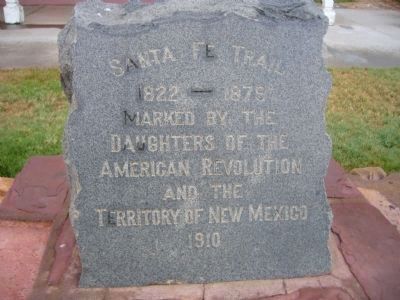
Photographed by Bill Kirchner
5. Santa Fe Trail
Marked by the
Daughters of the
American Revolution
and the
Territory of New Mexico
1910
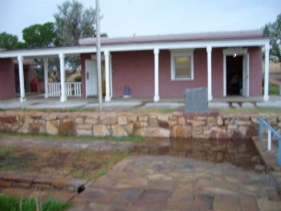
Photographed by Bill Kirchner
6. Santa Fe Trail D.A.R Marker
Credits. This page was last revised on March 11, 2026. It was originally submitted on August 8, 2011, by Bill Kirchner of Tucson, Arizona. This page has been viewed 1,180 times since then and 31 times this year. Photos: 1. submitted on August 8, 2011, by Bill Kirchner of Tucson, Arizona. 2. submitted on August 9, 2011, by Bill Kirchner of Tucson, Arizona. 3. submitted on August 8, 2011, by Bill Kirchner of Tucson, Arizona. 4. submitted on August 9, 2011, by Bill Kirchner of Tucson, Arizona. 5, 6. submitted on August 8, 2011, by Bill Kirchner of Tucson, Arizona. • Bernard Fisher was the editor who published this page.
