Cornell in Chippewa County, Wisconsin — The American Midwest (Great Lakes)
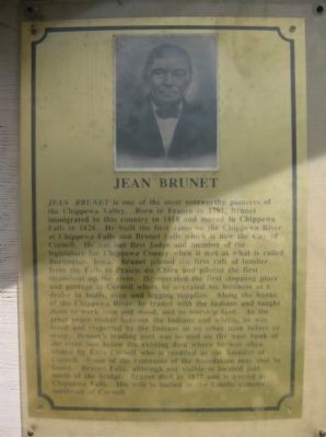
Jean Brunet
Photographed by Keith L, July 21, 2011
1. Jean Brunet Marker
this page online
Erected by the Chippewa County Historical Society. (Marker Number 41.)
Topics. This historical marker is listed in these topic lists: Indigenous Peoples and Communities • Industry & Commerce • Settlements & Settlers • Waterways & Vessels. A significant historical year for this entry is 1791.
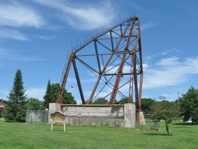
Location. 45° 9.965′ N, 91° 9.324′ W. Marker is in Cornell, Wisconsin, in Chippewa County. It can be reached from Bridge Street (State Highway 64) 0.2 miles west of Park Road, on the right when traveling west. Marker is located in Mill Yard Park by the Cornell Pulpwood Stacker. Touch for map. Marker is at or near this postal address: 51 Bridge Street, Cornell WI 54732, United States of America. Touch for directions.

Regionally, this marker is in the American Midwest and in the Corn Belt. Globally, it is in North America, the Western Hemisphere, the Western World, and the Anglosphere. Historically, it finds
Photographed by Keith L, July 21, 2011
2. Jean Brunet Marker
Other nearby markers. At least 8 other markers are within 9 miles of this marker, measured as the crow flies: Pulpwood Stacker (here, next to this marker); Ezra Cornell (here, next to this marker); Cornell Pulpwood Stacker (about 300 feet away, measured in a direct line); Cornell Women's Club Tablet (approx. half a mile away); Holcombe Logging Disaster (approx. 4.3 miles away); The Holcombe Indian (approx. 4.3 miles away); The Cobban Bridge (approx. 4.9 miles away); Bohemian National Cemetery (approx. 8.4 miles away). Touch for a list and map of all markers in Cornell.
Photographed by Keith L, July 21, 2011
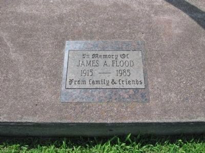
3. Tablet at Nearby Flag Pole
James A. Flood
1915 – 1985
From family & friends
Credits. This page was last revised on October 14, 2020. It was originally submitted on August 11, 2011, by Keith L of Wisconsin Rapids, Wisconsin. This page has been viewed 1,474 times since then and 48 times this year. Photos: 1, 2, 3. submitted on August 11, 2011, by Keith L of Wisconsin Rapids, Wisconsin.
