Central Business District in Lynchburg, Virginia — The American South (Mid-Atlantic)
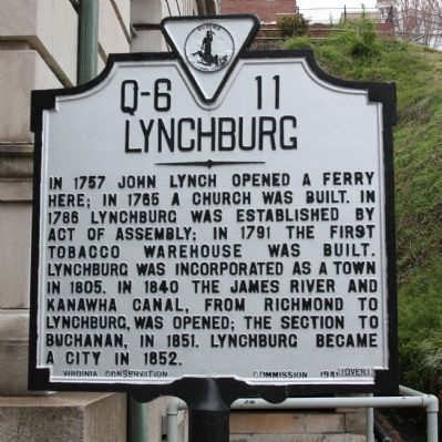
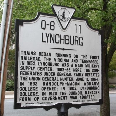
Lynchburg
Trains began running on the first railroad, the Virginia and Tennessee, in 1852. Lynchburg was a main military supply center, 1862–65. Here the Confederates under General Early defeated the Union General Hunter, June 18, 1864. In 1863 Randolph-Macon Woman’s College opened; in 1903, Lynchburg College. In 1920 the council-manager form of government was adopted.
Erected 1941 by Virginia Conservation Commission. (Marker Number Q-6-11.)
Topics and series. This historical marker is listed in these topic lists: Colonial Era • Peace • Settlements & Settlers • War, US Civil • Waterways & Vessels. In addition, it is included in the Virginia Department of Historic Resources (DHR) series list. A significant historical date for this entry is June 18, 1822.
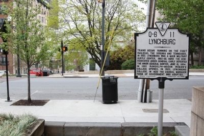
Location. 37° 24.851′ N, 79° 8.592′ W. Marker is in Lynchburg, Virginia. It is in the Central Business District. Marker is at the intersection of Church Street and 9th Street, on the right when traveling south on Church Street. Touch for map. Marker is in this post office area: Lynchburg VA 24504, United States of America. Touch for directions.
Other nearby markers. At least 8 other markers are within walking distance of this marker. John Lynch (a few steps from this marker); Soldiers, Sailors, and Marines of the Spanish American War (a few steps from this marker); Lynchburg History (within shouting distance of this marker); a different marker also named Lynchburg History (within shouting distance of this marker); World War II (within shouting distance of this marker); Korean War (within shouting distance of this marker); Mr. Elder’s Rose Garden (within shouting distance of this marker); POW★MIA (within shouting distance of this marker). Touch for a list and map of all markers in Lynchburg.
More about this marker. This is the only official Virginia roadside marker where text is continued from one side to the other. Notice the word “over” in parenthesis on the lower right hand corner of each side. Most Virginia state markers have identical faces on their two sides. The exception are the county-line markers and a few “city” (Q series) markers. On markers with different sides, all but this one have a different title on each side and the text on one side is independent of the other.
Regarding Lynchburg. Lynchburg is the only city of its size not on the interstate highway system. This marker was erected at the height of the passenger train era, when Lynchburg was served by three different railroads—for two of them their main lines—with a total of 55 daily passenger trains, many with with through cars to Atlanta, Birmingham, Boston, Charlotte, Cleveland, Cincinnati, Columbus, Durham, Memphis, Nashville, New Orleans, New York, Richmond and Washington. These railroads were the Norfolk and Western (successor to the Virginia and Tennessee), the Southern, and the Chesapeake and Ohio.
Also see . . . The History of Lynchburg, Virginia, An Overview. “By the early 1800s, tobacco was the city’s major economy, with numerous warehouses processing and shipping the product east to Richmond by river batteaux. 1817 saw the beginnings of construction of the Salem Turnpike (the roadbed of what is now U.S. 460 between Lynchburg and Roanoke) as well as a toll bridge across the James River (this bridge was at 9th street, at the original ferry site). John Lynch (founder of the ferry, the town, and who also headed the toll bridge project) died on October 31, 1820, and was buried in the cemetery beside the Quaker Meeting House. ” (Submitted on September 4, 2011.)
Credits. This page was last revised on February 1, 2023. It was originally submitted on August 24, 2011, by J. J. Prats of Powell, Ohio. This page has been viewed 857 times since then and 26 times this year. Photos: 1, 2, 3. submitted on August 24, 2011, by J. J. Prats of Powell, Ohio.


