Port Orange in Volusia County, Florida — The American South (South Atlantic)
Living on the Edge
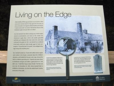
Even the Marshalls' best efforts could go awry. Hired workers strained accommodations and nerves at this remote site. Dunlawton's supply ship - a link to the outside - grounded and broke up in Mosquito Inlet. And, worst of all, cane crops continued to be spotty. By 1851, one Marshall son wondered if the family could even make enough sugar for home consumption. "It would be bad," he mused, "to be obliged to buy sugar along with everything else."
Mrs. Marshall wanted out. Faced with endless factory repairs (and workers in her house), concerned about her children's education, and troubled by the poor cane crops, she put her faith in a relative's upcoming visit. "I hope he may take a fancy to Dunlawton and give your father a good price for it," she told a son. "I shall then hope to leave Florida." But that was not to be. On November 20, 1852, Maria Marshall died in childbirth at Dunlawton - far from the settled South Carolina community of her youth.
[ Postcard ]
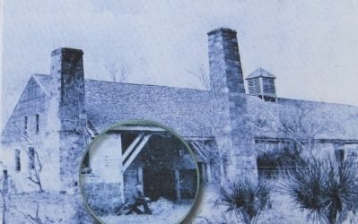
One last visit to Dunlawton? Tradition has it (without proof) that this photo's lone figure is Benjamin Marshall - son of Maria and John. Decades after his mother's sudden death here, Ben Marshall returned from Louisiana to help sell the old sugar plantation.
Early twentieth-century postcard (from a nineteenth-century photo) courtesy of Tom Baskett, Jr.
[ Photo ]
A memorial stone in Louisiana for Maria Hawes Marshall (1812-1852). She probably was buried on the Dunlawton plantation (with twins who died at birth), but the Red River country became her surviving family's new home.
Marker in the All Saints Episcopal Church cemetery, DeSoto Parish. Photo courtesy of Audrey M. Blagg and Marshall Juergens.
Erected by Volusia County and the State of Florida, Department of State, Division of Historical Resources, assisted by the Florida Historical Commission.
Topics. This historical marker is listed in these topic lists: Agriculture • Industry & Commerce • Settlements & Settlers • Wars, US Indian. A significant historical month for this entry is November 1849.
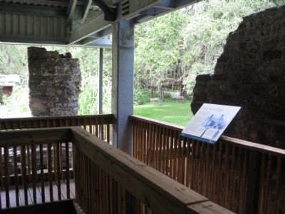
Location. 29° 8.482′ N, 81° 0.348′ W. Marker is in Port Orange, Florida, in Volusia County. Marker can be reached from Old Sugar Mill Road east of Herbert Street, on the left when traveling east. The marker is on the grounds of the Dunlawton
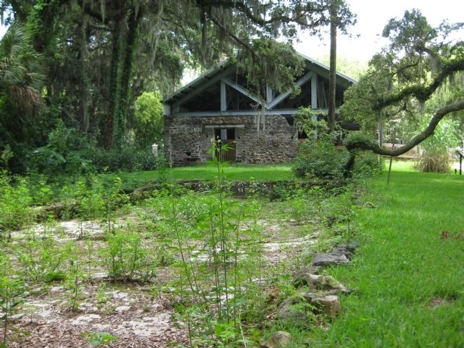
Sugar Mill Botanical Gardens, mounted along the boardwalk at the sugar mill ruins. Touch for map. Marker is at or near this postal address: 950 Old Sugar Mill Road, Port Orange FL 32129, United States of America. Touch for directions.
Other nearby markers. At least 8 other markers are within walking distance of this marker. Telling Dunlawton's Stories (a few steps from this marker); Dunlawton's Building Blocks (a few steps from this marker); Spanish Mills and Bongoland (a few steps from this marker); From the Boardwalk (a few steps from this marker); Sugar Making (a few steps from this marker); The Most Dangerous Chieftain (a few steps from this marker); Working (a few steps from this marker); Emathla (King Philip) (a few steps from this marker). Touch for a list and map of all markers in Port Orange.
More about this marker. The marker features the logos of Volusia County and the Florida Heritage program.
Regarding Living on the Edge. The site was listed with the National Register of Historic Places in 1973 under the name Dunlawton Plantation--Sugar Mill Ruins (# 73000606).
Related markers. Click here for a list of markers that are related to this marker. To better understand the story of the Dunlawton Plantation and Sugar Mill Ruins, study each marker in the order shown.
Credits. This page was last revised on June 16, 2016. It was originally submitted on August 26, 2011, by Glenn Sheffield of Tampa, Florida. This page has been viewed 767 times since then and 20 times this year. Photos: 1. submitted on August 26, 2011, by Glenn Sheffield of Tampa, Florida. 2, 3, 4. submitted on August 27, 2011, by Glenn Sheffield of Tampa, Florida. • Bill Pfingsten was the editor who published this page.


