St. Johns Bluff in Jacksonville in Duval County, Florida — The American South (South Atlantic)
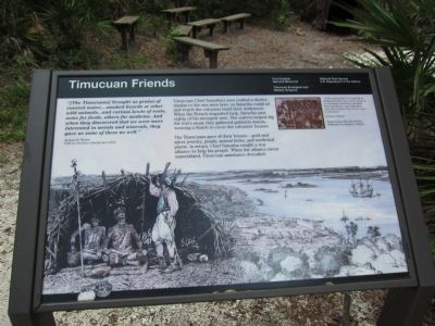
Timucuan Friends
Fort Caroline National Monument
| — | Timucuan Ecological and Historic Preserve | — |
Photographed by Craig Swain, July 31, 2011
1. Timucuan Friends Marker
Jacques le Moyne, 1564 la Caroline colonist and artist
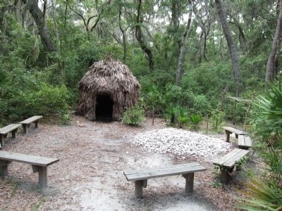
Timucuan Chief Saturiba's men crafted a shelter, similar to the one seen here, so Saturiba could sit and watch the colonists build their settlement. When the French requested help, Saturiba sent eighty of his strongest men. The natives helped dig the fort's moat; they gathered palmetto leaves, weaving a thatch to cover the colonists' houses.
The Timucuans gave of their bounty - gold and silver jewelry, pearls, animal hides, and medicinal plants. In return, Chief Saturiba sought a war alliance to help his people. When the alliance never materialized, Timucuan assistance dwindled.
"If the natives had not supplied us daily from their own stores, some of us certainly would have perished from starvation, especially those who did not know how to use a gun in the hunt."
Jacques le Moyne
Erected by National
this page online
Topics. This historical marker is listed in these topic lists: Colonial Era • Indigenous Peoples and Communities. A significant historical year for this entry is 1564.
Location. 30° 23.18′ N, 81° 29.916′ W. Marker is in Jacksonville, Florida, in Duval County. It is in St. Johns Bluff. It can be reached from Ft. Caroline Road, on the left when traveling east. Located on the tour trail from the visitor center in Fort Caroline National Monument. Touch for map. Marker is in this post office area: Jacksonville FL 32225, United States of America. Touch for directions.

Regionally, this marker is in First Coast. It is also in the American South and on the Eastern Seaboard. Globally, it is in the North Atlantic Region, North America, a Gulf of Mexico state, the Western Hemisphere, the Western World, and the Anglosphere. Historically, it finds itself in what was once New Spain, the territory of the Mississippian Culture, one of the Confederate States of America, and the Antebellum South.
Other nearby markers. At least 8 other markers are within walking distance of this marker:
Photographed by Craig Swain, July 31, 2011
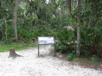
2. Timucuan Friends Marker
Also see . . . Timucuan Ecological and Historical Preserve website. (Submitted on August 27, 2011, by Craig Swain of Leesburg, Virginia.)
Photographed by Craig Swain, July 31, 2011
3. Reconstructed Timucuan Hut
Credits. This page was last revised on February 3, 2023. It was originally submitted on August 27, 2011, by Craig Swain of Leesburg, Virginia. This page has been viewed 863 times since then and 36 times this year. Photos: 1, 2, 3. submitted on August 27, 2011, by Craig Swain of Leesburg, Virginia.
