Wauwatosa in Milwaukee County, Wisconsin — The American Midwest (Great Lakes)
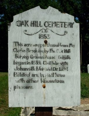
Oak Hill Cemetery
1853
Topics. This historical marker is listed in these topic lists: Cemeteries & Burial Sites • War, US Civil. A significant historical year for this entry is 1839.
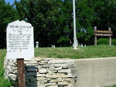
Location. 43° 5.361′ N, 88° 3.432′ W. Marker is in Wauwatosa, Wisconsin, in Milwaukee County. Marker is at the intersection of West Capitol Drive and U.S. 45, on the right when traveling west on West Capitol Drive. Marker is located along the freeway access road from west bound Capitol Drive to U.S. 45, on the east side of the freeway. Touch for map. Marker is in this post office area: Milwaukee WI 53222, United States of America. Touch for directions.
Other nearby markers. At least 8 other markers are within 4 miles of this marker, measured as the crow flies. Milwaukee County's First Airport (approx. 0.4 miles away); Revolutionary War Veteran (approx. 3 miles away); Milwaukee County Asylum Cemetery (approx. 3 miles away); City of Brookfield (approx. 3.1 miles away); Pioneer Cemetery (approx. 3.2 miles away); Charles Hart Homestead (approx. 3.3 miles away); Lowell Damon House (approx. 3.3 miles away); Wauwatosa Avenue Historic District (approx. 3.3 miles away). Touch for a list and map of all markers in Wauwatosa.
Credits. This page was last revised on June 16, 2016. It was originally submitted on August 30, 2011, by Paul Fehrenbach of Germantown, Wisconsin. This page has been viewed 943 times since then and 27 times this year. Photos: 1, 2, 3, 4, 5. submitted on August 30, 2011, by Paul Fehrenbach of Germantown, Wisconsin. • Craig Swain was the editor who published this page.
