Near Central in Washington County, Utah — The American Mountains (Southwest)
The Mountain Meadows Massacre
Photographed by Karen Key, November 24, 2008
1. The Mountain Meadows Massacre Marker
Inscription.
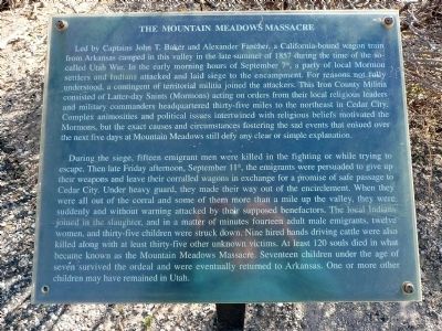
The Mountain Meadows Massacre. . Led by Captains John T. Baker and Alexander Fancher, a California-bound wagon train from Arkansas camped in this valley in the late summer of 1857 during the time of the so-called Utah War. In the early morning hours of September 7th, a party of local Mormon settlers and Indians attacked and laid siege to the encampment. For reasons not fully understood, a contingent of territorial militia joined the attackers. This Iron County Militia consisted of Latter-day Saints (Mormons) acting on orders from their local religious leaders and military commanders headquartered thirty-five miles to the northeast in Cedar City. Complex animosities and political issues intertwined with religious beliefs motivated the Mormons, but the exact causes and circumstances fostering the sad events that ensued over the next five days at Mountain Meadows still defy any clear or simple explanation. , , During the siege, fifteen emigrant men were killed in the fighting while trying to escape. Then late Friday afternoon, September 11th, the emigrants were persuaded to give up their weapons and leave their corralled wagons in exchange for a promise of safe passage to Cedar City. Under heavy guard, they made their way out of the encirclement. When they were all out of the corral and some of them more than a mile up the valley, they were suddenly and without warning attacked by their supposed benefactors. The local Indians joined in the slaughter, and in a matter of minutes fourteen adult male emigrants, twelve women, and thirty-five children were struck down. Nine hired hands driving cattle were also killed along with at least thirty-five other unknown victims. At least 120 souls died in what became known as the Mountain Meadows Massacre. Seventeen children under the age of seven survived the ordeal and were eventually returned to Arkansas. One or more other children may have remained in Utah.
Led by Captains John T. Baker and Alexander Fancher, a California-bound wagon train from Arkansas camped in this valley in the late summer of 1857 during the time of the so-called Utah War. In the early morning hours of September 7th, a party of local Mormon settlers and Indians attacked and laid siege to the encampment. For reasons not fully understood, a contingent of territorial militia joined the attackers. This Iron County Militia consisted of Latter-day Saints (Mormons) acting on orders from their local religious leaders and military commanders headquartered thirty-five miles to the northeast in Cedar City. Complex animosities and political issues intertwined with religious beliefs motivated the Mormons, but the exact causes and circumstances fostering the sad events that ensued over the next five days at Mountain Meadows still defy any clear or simple explanation.
During the siege, fifteen emigrant men were killed in the fighting while trying to escape. Then late Friday afternoon, September 11th, the emigrants were persuaded to give up their weapons and leave their corralled wagons in exchange for a promise of
Click or scan to see this page online
safe passage to Cedar City. Under heavy guard, they made their way out of the encirclement. When they were all out of the corral and some of them more than a mile up the valley, they were suddenly and without warning attacked by their supposed benefactors. The local Indians joined in the slaughter, and in a matter of minutes fourteen adult male emigrants, twelve women, and thirty-five children were struck down. Nine hired hands driving cattle were also killed along with at least thirty-five other unknown victims. At least 120 souls died in what became known as the Mountain Meadows Massacre. Seventeen children under the age of seven survived the ordeal and were eventually returned to Arkansas. One or more other children may have remained in Utah.
Location. 37° 28.617′ N, 113° 37.9′ W. Marker is near Central, Utah, in Washington County. It can be reached
Photographed by Karen Key, November 24, 2008
2. The Mountain Meadows Massacre Marker
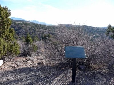
from Highway 18. There is a marked parking area just off the highway and then a foot path that leads you to the plaque. Touch for map. Marker is in this post office area: Central UT 84722, United States of America. Touch for directions.
Regionally, this marker is in Utah’s Color Country. It is also in the American Southwest, in the Mountain West, and in Colorado Plateau. Globally, it is in North America, the Rocky Mountains, the Western Hemisphere, the Western World, and the Anglosphere. Historically, it finds itself in what was once New Spain and also Mexico’s Alta California.
Regarding The Mountain Meadows Massacre. In June 2011, the Mountain Meadows Site was designated as a National Historic Landmark.
Related markers. Click here for a list of markers that are related to this marker.
Also see . . . Mountain Meadows Association. (Submitted on December 26, 2008, by Karen Key of Sacramento, California.)
Photographed by Bill Kirchner, August 29, 2011
4. Massacre Site (View north from Dan Sill Hill)
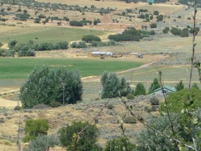
Travelers entering Mountain Meadows from the north crossed the rim of the basin near the location in the photo. Pack trains stayed to the far (west) side of the valley, but wagons chose a less marshy route nearer this side. Most of the Baker-Fancher Party were killed on September 11, 1857, as they were being escorted out of the valley heading north. The photo locates the approximate site of the massacre and of an 1859 stone monument marking one of the burial sites.
Credits. This page was last revised on June 16, 2016. It was originally submitted on December 26, 2008, by Karen Key of Sacramento, California. This page has been viewed 2,555 times since then and 26 times this year. Last updated on September 2, 2011, by Bill Kirchner of Tucson, Arizona. Photos:1, 2, 3. submitted on December 26, 2008, by Karen Key of Sacramento, California. 4. submitted on September 2, 2011, by Bill Kirchner of Tucson, Arizona. • Bill Pfingsten was the editor who published this page.