Ovid in Sedgwick County, Colorado — The American Mountains (Southwest)
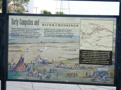
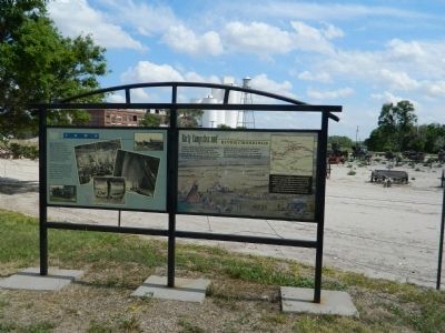
Early Campsites and River Crossings
Photographed by Beverly Pfingsten, June 13, 2011
1. Early Campsites and River Crossings Marker
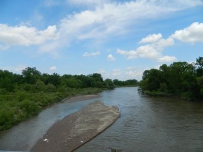
A branch of the Overland Route paralleled Lodgepole Creek into Nebraska. This waterway is possibly the longest "creek" in the United States, flowing over 150 miles from its origin in the mountains of Wyoming to join the South Platte River. The width of the Lodgepole Valley suggests that the creek was once much larger than the quiet stream seen here today.
Topics. This historical marker is listed in these topic lists: Indigenous Peoples and Communities • Settlements & Settlers • Waterways & Vessels. A significant historical year for this entry is 1865.
Location. 40° 57.647′ N, 102° 23.045′ W. Marker is in Ovid, Colorado, in Sedgwick County. It is on U.S. 138 just east of 2nd Street, on the right when traveling east. Touch for map.
this page online

Regionally, this marker is in the Eastern Plains. It is also in the American Mountain West, on the Great Plains, and specifically on the High Plains. Globally, it is in North America, the Western Hemisphere, the Western World, and the Anglosphere. Historically, it finds itself in what was once the Louisiana Purchase.
Other nearby markers. At least 8 other markers are within 2 miles of this marker, measured as the crow flies: Sugar Town (here, next to this marker); Fort Sedgwick (here, next to this marker); See and Do,Off the Byway (approx. 0.2 miles away); Prisoners on the Plains / Ride 'Em Cowboy (approx. 0.2 miles away); Ovid, Colorado (approx. 0.2 miles away); "Dinky" Locomotive (approx. 0.3 miles away); Fort Sedgwick, Colorado Territory (approx. 1½ miles away); Hard Duty on the Plains (approx. 1½ miles away). Touch for a list and map of all markers in Ovid.
Photographed by Beverly Pfingsten, June 13, 2011
2. Early Campsites and River Crossings Marker
Photographed by Beverly Pfingsten, June 13, 2011
3. South Platte River
Credits. This page was last revised on June 16, 2016. It was originally submitted on September 19, 2011, by Bill Pfingsten of Bel Air, Maryland. This page has been viewed 1,204 times since then and 57 times this year. Photos: 1, 2, 3. submitted on September 19, 2011, by Bill Pfingsten of Bel Air, Maryland.
