Near Richmond in Henrico County, Virginia — The American South (Mid-Atlantic)
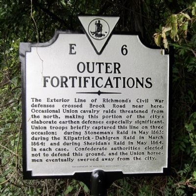
Outer Fortifications
Erected 2010 by Department of Historic Resources. (Marker Number E-6.)
Topics and series. This historical marker is listed in this topic list: War, US Civil. In addition, it is included in the Virginia Department of Historic Resources (DHR) series list. A significant historical month for this entry is March 1864.
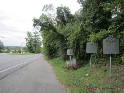
Location. 37° 36.679′ N, 77° 27.415′ W. Marker is near Richmond, Virginia, in Henrico County. Marker is on Brook Road (U.S. 1) 0.2 miles north of Brook Run Drive, on the right when traveling north. Touch for map. Marker is in this post office area: Richmond VA 23227, United States of America. Touch for directions.
Other nearby markers. At least 8 other markers are within walking distance of this marker. Richmond Defences (here, next to this marker); Campaign of 1781 (here, next to this marker); Brook Road (a few steps from this marker); Stuart's Ride (about 400 feet away, measured in a direct line); Confederate Fortifications (about 500 feet away); The Fort Under Attack (about 500 feet away); Gabriel’s Insurrection (about 500 feet away); Gabriel's Rebellion (approx. 0.3 miles away). Touch for a list and map of all markers in Richmond.
Credits. This page was last revised on June 16, 2016. It was originally submitted on September 19, 2011, by Bernard Fisher of Richmond, Virginia. This page has been viewed 1,187 times since then and 39 times this year. Photos: 1, 2. submitted on September 19, 2011, by Bernard Fisher of Richmond, Virginia. 3. submitted on February 8, 2009, by Bernard Fisher of Richmond, Virginia.


