St. Augustine in St. Johns County, Florida — The American South (South Atlantic)
Tolomato Cemetery
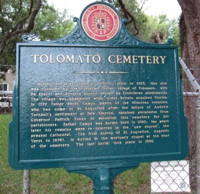
Photographed by Craig Swain, August 1, 2011
1. Tolomato Cemetery Marker
Erected by St. Johns County Historical Commission.
Topics. This historical marker is listed in these topic lists: Cemeteries & Burial Sites • Indigenous Peoples and Communities • Religion & Religious Structures. A significant historical year for this entry is 1763.
Location. 29° 53.817′ N, 81° 18.891′ W. Marker is in St. Augustine, Florida,
this page online

Regionally, this marker is in First Coast and in Greater Jacksonville. It is also in the American South and on the Eastern Seaboard. Globally, it is in the North Atlantic Region, North America, a Gulf of Mexico state, the Western Hemisphere, the Western World, and the Anglosphere. Historically, it finds itself in what was once New Spain, the territory of the Mississippian Culture, one of the Confederate States of America, and the Antebellum South.
Other nearby markers. At least 8 other markers are within walking distance of this marker: Tolomato Indian Village (within shouting distance of this marker); The Rosario Defense Line (within shouting distance of this marker); The 1886 Old Drugstore (within shouting distance of this marker); Santo Domingo Redoubt (about 300 feet away, measured in a direct line); a different marker also named Santo Domingo Redoubt (about 300 feet away);
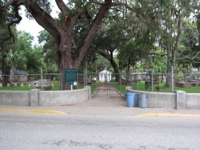
Photographed by Craig Swain, August 1, 2011
2. Tolomato Cemetery Entrance and Marker
Credits. This page was last revised on January 2, 2019. It was originally submitted on September 19, 2011, by Craig Swain of Leesburg, Virginia. This page has been viewed 902 times since then and 30 times this year. Photos: 1, 2. submitted on September 19, 2011, by Craig Swain of Leesburg, Virginia.
