Natural Bridge in Rockbridge County, Virginia — The American South (Mid-Atlantic)
Natural Bridge
Photographed by J. J. Prats, October 14, 2000
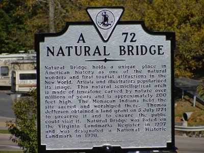
1. Natural Bridge Marker
Erected 2000 by Department of Historic Resources. (Marker Number A-72.)
Topics and series. This historical marker is listed in these topic lists: Bridges & Viaducts • Landmarks • Natural Features • Roads & Vehicles. In addition, it is included in the Former U.S. Presidents: #03 Thomas Jefferson, the George Washington Slept Here, the National Historic Landmarks, and the Virginia Department of Historic Resources (DHR) series lists. A significant historical date for this entry is July 5, 1774.
Location. 37° 37.761′ N, 79° 32.581′ W.
this page online

Regionally, this marker is in the Mountain Region. It is also in the American South, specifically in the Upper South, in Appalachia, and specifically in Southern Appalachia. Globally, it is in North America, the Western Hemisphere, the Western World, and the Anglosphere. Historically, it finds itself in what was once the territory of the Mississippian Culture, one of the original Thirteen Colonies, one of the Confederate States of America, and the Antebellum South.
Other nearby markers. At least 5 other markers are within walking distance of this marker: A different marker also named Natural Bridge (within shouting distance of this marker); Natural Bridge Patent (about 600 feet away, measured in a direct line); “Vires-Acquirit-Eundo” Ancient Arbor Vitae
Photographed by J. J. Prats, October 14, 2000
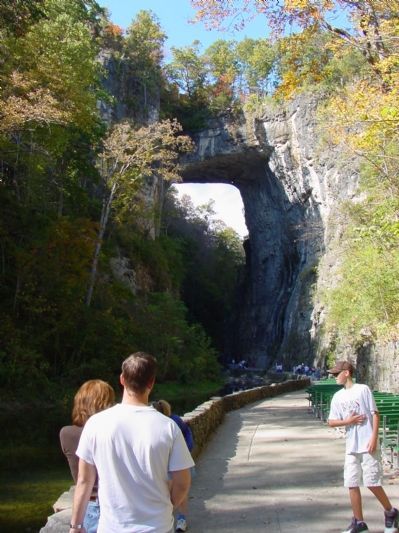
2. The Natural Bridge
Another marker is no longer nearby. Natural Bridge (was within shouting distance of this marker but has been permanently removed).
More about this marker. This marker replaced a 1930s marker with the same number and title. The inscription on that marker read “Legend says that the Monocan Indians called it ‘The Bridge of God’ and worshipped it. Thomas Jefferson was the first American owner, patenting it with 157 acres on July 5, 1774, ‘for twenty shillings of good and lawful money.’ Millions of years old, Natural Bridge is considered one of the seven natural wonders of the world.”
Regarding Natural Bridge. 215 feet high, 40 feet thick, 100 feet wide with a 90 foot span between the walls. The arch contains 450,000 cubic feet of rock weighing 72,000,000 pounds or 36,000 tons and is estimated to be at least 500 million years old. At it's peak, the bridge is 1,160 feet above sea level. It crosses Cedar Creek.
Lee
Photographed by J. J. Prats, October 14, 2000
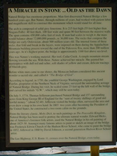
3. About this Natural Wonder
Also see . . . The Natural Bridge Zoological Park. Home to the largest, most complete collection of animals and birds in the state of Virginia and breeding center for rare and endangered species. (Submitted on December 31, 2005, by J. J. Prats of Powell, Ohio.)
Additional commentary.
1. A Miracle in Stone . . . Old as the Dawn
The Text on Photograph No. 3:
“ Natural Bridge has enormous proportions. Man first discovered Natural Bridge a few hundred years ago. But Nature, through millions of years, had worked with patient labor and magnificent skill to construct this monument which would stand for all time.
“ The arch is composed of solid grey limestone. It is 215 feet high (55 feet higher than Niagara Falls) 40 feet thick, 100 feet wide and spans 90 feet between massive walls. The span contains 450,000 cubic feet of rock. If man had scales to weigh it the mass would balance about 72,000,000 pounds, or 36,000 tons. The rocks that compose the bridge are early Ordovician, about 500 million years old. The internal
Photographed by J. J. Prats, October 14, 2000
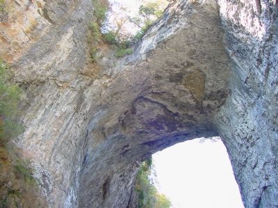
4. Under Natural Bridge Looking Up
US Route 11 runs along the top of the rock formation. This was the main road between Roanoke and Staunton before Interstate 81 was built. US 11 runs from the Canadian border at Champlain, New York, to New Orleans, Louisiana.
“ This was nature's working material. Her tool, Cedar Creek. A simple mountain stream flowing towards the sea. With these, Nature achieves her miracle. She painted her masterpiece with dull red and ochre, soft shades of yellow and cream, delicate tracings of blueish-grey.
“ Before white men came to our shores, the Monacan Indians considered this ancient wonder a sacred site, and called it ‘The Bridge of God.’
“ According to legend, in 1750, the youthful George Washington, engaged by Lord Fairfax, proprietor of the Northern Neck of Virginia, surveyed the surrounding acreage of Natural Bridge. During his visit he scaled some 23 feet up the left wall of the bridge, and carved his initials ‘G.W.’, which may still be seen today.
“ On July 5, 1774, Thomas Jefferson purchased Natural Bridge and 157 surrounding acres from King George III of England
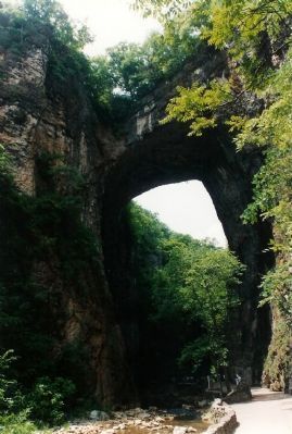
Photographed by Michael Stroud, June 1994
5. The Natural Bridge View from 1994
“ From the literary classic, Moby Dick, to such paintings as The Peaceable Kingdom, Natural Bridge has been used to portray the ultimate natural wonder. Edward Hicks, one of America's foremost folk artists, used the Natural Bridge on his oil painting of about 1825-30. Amongst many famous artists to paint or sketch an image of the bridge was Frederick Edwin Church of the Hudson River School, who came to paint the bridge in 1852, followed in 1860 by David Johnson, a second generation Hudson River School artist.
“ The Lee Highway, U.S. Route 11, crosses over the Natural Bridge, even today. ”
— Submitted January 14, 2006, by J. J. Prats of Powell, Ohio.
Photographed by J. J. Prats, October 14, 2000
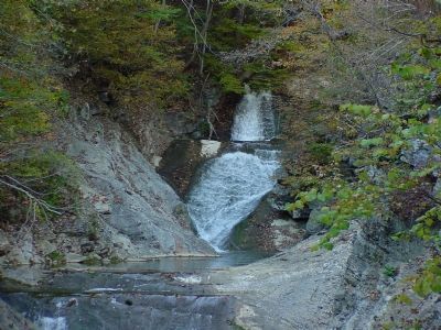
6. Lace Waterfalls
The waterfalls are just beyond (west of) Natural Bridge, and reachable on the concrete path.
Photographed by Edward John Cunningham, May 25, 2008
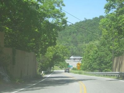
7. Photo of Route 11 as it goes over Natural Bridge.
The wooden panels on either side can also be seen from the bottom of the gorge and identify where the bridge exactly is.
July 19, 2010
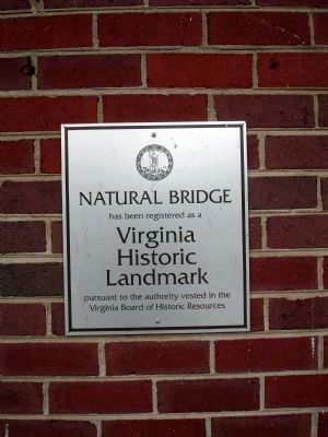
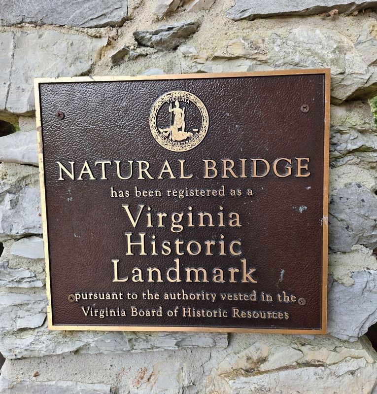
8. Plaque at the Natural Bridge Visitor Center
Natural Bridge
has been registered as a
Virginia
Historic
Landmark
pursuant to the authority vested in the
Virginia Board of Historic Resources
Photographed by Bradley Owen, August 12, 2024
9. Plaque Along Cedar Creek Trail
has been registered as a
Virginia Historic Landmark
pursuant to the authority vested in the Virginia Board of Historic Resources
Photographed by Bradley Owen, August 12, 2024
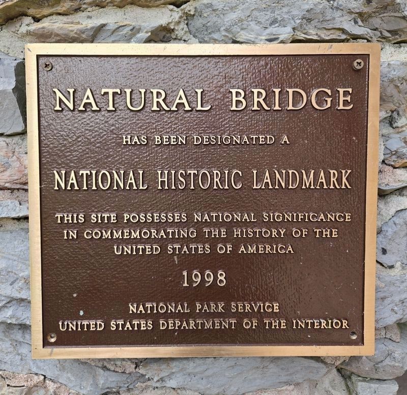
10. Additional Plaque Along Cedar Creek Trail
has been designated a
National Historic Landmark
This site possesses National significance in commemorating the history of the United States of America
1998
National Park Service
United States Department of the Interior
Credits. This page was last revised on August 12, 2024. It was originally submitted on December 31, 2005, by J. J. Prats of Powell, Ohio. This page has been viewed 78,754 times since then and 810 times this year. Photos: 1, 2, 3, 4. submitted on December 31, 2005, by J. J. Prats of Powell, Ohio. 5. submitted on December 31, 2007, by Mike Stroud of Bluffton, South Carolina. 6. submitted on December 31, 2005, by J. J. Prats of Powell, Ohio. 7. submitted on May 26, 2008, by Edward John Cunningham of Derwood, Maryland. 8. submitted on July 23, 2010. 9, 10. submitted on August 12, 2024, by Bradley Owen of Morgantown, West Virginia.
