Niagara-on-the-Lake in Niagara Region, Ontario — Central Canada (North America)
Action at Butler's Farm
Engagement a Butler's Farm
Photographed by Dale K. Benington, July 27, 2011
1. Action at Butler's Farm Marker
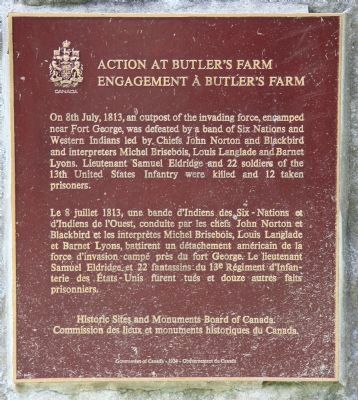
Le 8 juillet 1813, une bande d'Indiens des Six-Nations et d'Indiens de l'Ouest, conduite par les chefs John Norton et Blackbird et les interprètes Michel Brisebois, Louis Langlade et Barnet Lyons battirent un détachement américain de la force d'invasion campé près du fort George. Le lieutenant Samuel Eldridge et 22 fantassins du 13e Régiment d'Infanterie des États-Unis furent tués et douze autres faits prisonniers.
Erected by Historic Sites and Monuments Board of Canada.
Topics and series. This historical marker is listed in these topic lists: Colonial Era • War of 1812. In addition, it is included in the Canada, Historic Sites and Monuments Board series list. A significant historical date for this entry is July 8, 1813.
Location. 43° 15.074′ N, 79° 5.434′ W.
this page online

Regionally, this marker is on the Golden Horseshoe and in Niagara Canada. It is also in Central Canada. Globally, it is in North America, on the Great Lakes, in the Western Hemisphere, in the Western World, and in the Anglosphere. Historically, it finds itself in what was once a British colony, the Viceroyalty of New France, the Haudenosaunee (Iroquois) Confederacy, and Rupert’s Land.
Other nearby markers. At least 8 other markers are within walking distance of this marker: The Claus Family Crypt / La crypté de la famille Claus (a few steps from this marker); Butler's Burial Ground (within shouting distance of this marker); Lieutenant-Colonel John Butler 1725-1796 (within shouting distance of this marker); Memorial Cairn For John Butler (about 180 meters away,
Photographed by Dale K. Benington, July 27, 2011
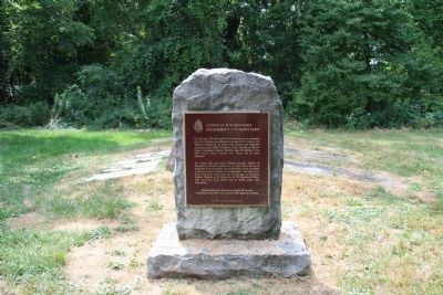
2. Action at Butler's Farm Marker
Another marker is no longer nearby. Negro Burial Ground (was approx. half a kilometer away but has been confirmed missing).
Photographed by Dale K. Benington, July 27, 2011
3. Action at Butler's Farm Marker
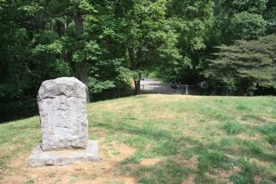
View looking east towards the end of Butler Street, with the backside of the historic maker (seemingly missing another historic plaque or marker on the backside) visible in the foreground.
Photographed by Dale K. Benington, July 27, 2011
4. Action at Butler's Farm Marker
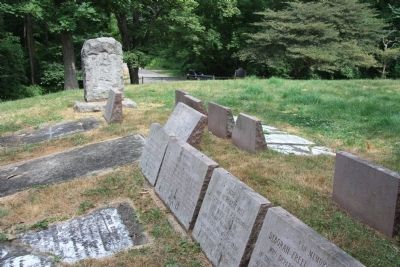
View looking east at two rows of gravestones with the backside of the historic marker at the end of the rows of gravestones, and beyond that the end of Butler Street in the distant background.
Credits. This page was last revised on September 27, 2019. It was originally submitted on October 25, 2011, by Dale K. Benington of Toledo, Ohio. This page has been viewed 1,099 times since then and 43 times this year. Photos: 1, 2, 3, 4. submitted on October 28, 2011, by Dale K. Benington of Toledo, Ohio.
