Near Niagara-on-the-Lake in Niagara Region, Ontario — Central Canada (North America)
Vrooman's Battery
La Batterie Vrooman
Photographed by Dale K. Benington, July 27, 2011
1. Vrooman's Battery Marker
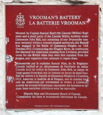
Manoeuvrée par le capitaine Samuel Hatt, du 5e Régiment Lincoln (milice) et un détachement de l'artillerie de milice Lincoln sous les ordres du lieutenant John Ball, ce canon de vingt-quatre livres était mis en batterie en forme de demi-lune. Elle fut utilisée à la bataille de Queenston Heights le 13 octobre 1812. Assurant la maîtrise de la Niagara, son tir continu harcela les Américaines qui traversaient la rivière à Lewiston, couvrit les troupes britanniques repoussées des hauteurs et appuya leurs tentatives ultérieures pour les reprendre.
Erected by Historic Sites and Monuments Board
this page online
Topics and series. This historical marker is listed in these topic lists: Colonial Era • War of 1812. In addition, it is included in the Canada, Historic Sites and Monuments Board series list. A significant historical date for this entry is October 13, 1812.
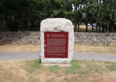
Location. 43° 10.657′ N, 79° 3.494′ W. Marker is near Niagara-on-the-Lake, Ontario, in Niagara Region. It is on Niagara Parkway north of Line 8 Road, on the right when traveling north. This historic marker is located on the river side of the roadway, a short distance north of the site of the Battle of Queenston Heights and south of the site of Fort George. Touch for map. Marker is at or near this postal address: 14759 Niagara Parkway, Niagara-on-the-Lake ON L0S 1J0, Canada. Touch for directions.

Regionally, this marker is on the Golden Horseshoe and in Niagara Canada. It is also in Central Canada. Globally, it is in North America, on the Great Lakes, in the Western Hemisphere, in the Western World, and in the Anglosphere. Historically, it finds itself in what was once a British colony, the Viceroyalty of New France, the Haudenosaunee (Iroquois) Confederacy,
Photographed by Dale K. Benington, July 27, 2011
2. Vrooman's Battery Marker
Other nearby markers. At least 8 other markers are within walking distance of this marker: The Silo Caboose (approx. 0.8 kilometers away in the U.S.); Township of Niagara War Memorial (approx. 0.8 kilometers away); Freedom Crossing Monument (approx. 0.9 kilometers away in the U.S.); a different marker also named Freedom Crossing Monument (approx. 0.9 kilometers away in the U.S.); The Battle of Queenston Heights (approx. 0.9 kilometers away in the U.S.); a different marker also named The Battle of Queenston Heights (approx. 0.9 kilometers away in the U.S.); Chloe Cooley and the 1793 Act to Limit Slavery in Upper Canada (approx. 0.9 kilometers away); Willowbank (approx. 1.1 kilometers away). Touch for a list and map of all markers in Niagara-on-the-Lake.
Photographed by Dale K. Benington, July 27, 2011
3. Vrooman's Battery Marker
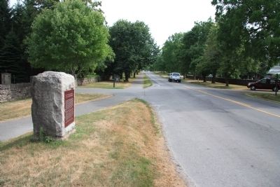
View of the historical marker looking south along the Niagara Parkway.
Photographed by Dale K. Benington, July 27, 2011
4. Vrooman's Battery Marker
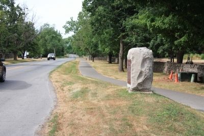
View of the historical marker looking north along the Niagara Parkway.
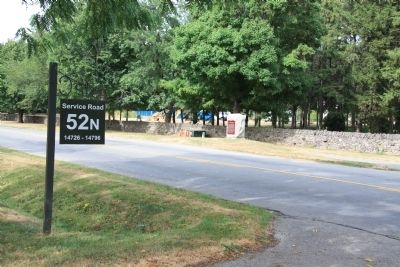
Photographed by Dale K. Benington, July 27, 2011
5. Vrooman's Battery Marker
View of the historic marker as seen from across the street by the intersection of the 52n Service Road.
Credits. This page was last revised on September 27, 2019. It was originally submitted on October 25, 2011, by Dale K. Benington of Toledo, Ohio. This page has been viewed 910 times since then and 27 times this year. Photos: 1, 2, 3, 4, 5. submitted on October 28, 2011, by Dale K. Benington of Toledo, Ohio.
