Worcester in Worcester County, Massachusetts — The American Northeast (New England)
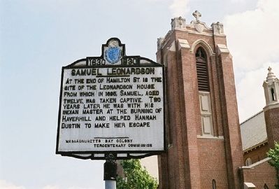
Samuel Leonardson
1630 - 1930
Erected 1930 by Massachusetts Bay Colony-Tercentenary Commission.
Topics and series. This historical marker is listed in these topic lists: Colonial Era • Native Americans. In addition, it is included in the Massachusetts Bay Colony—Tercentenary Commission Markers series list. A significant historical year for this entry is 1695.
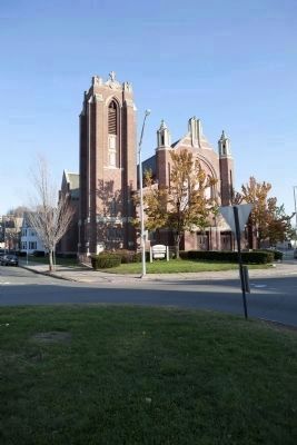
Location. Marker has been reported missing. It was located near 42° 15.346′ N, 71° 47.112′ W. Marker was in Worcester, Massachusetts, in Worcester County. Marker was at the intersection of Grafton Street (Massachusetts Route 122) and Hamilton Street, on the left when traveling north on Grafton Street. Marker is on war memorial round about which forms Billings Square. Touch for map. Marker was in this post office area: Worcester MA 01604, United States of America. Touch for directions.
Other nearby markers. At least 8 other markers are within walking distance of this location. Jonas Rice (approx. 0.4 miles away); Jonas Rice Homesite (approx. half a mile away); The United Nations Defensive (approx. 0.7 miles away); The United Nations Offensive (approx. 0.7 miles away); Communist Chinese Intervention (approx. 0.7 miles away); The 65th Infantry Regiment / El Regimiento Del 65 De Infantería (approx. 0.7 miles away); Forgotten No More (approx. 0.7 miles away); The Central Massachusetts Korean War Memorial (approx. 0.7 miles away). Touch for a list and map of all markers in Worcester.
Also see . . . Historical Markers Erected by Massachusetts Bay Colony Tercentenary Commission (1930). Original 1930 publication by the Commonwealth of Massachusetts of Tercentenary Commission Markers, commemorating the three hundredth anniversary of the Massachusetts Bay Colony. (Submitted on July 31, 2011, by Russell Chaffee Bixby of Bernardston, Massachusetts.)
Additional commentary.
1. Marker Disappearance
This marker was located on The War Memorial round-about at Billings Square in Worcester. Examination of the known location in November 2011 confirms that it has been removed, circumstances unknown. Preservation Worcester has been notified and promises notification if the whereabouts of the marker can be determined.
— Submitted November 13, 2011, by Russell Chaffee Bixby of Bernardston, Massachusetts.
Credits. This page was last revised on June 23, 2020. It was originally submitted on July 31, 2011, by Russell Chaffee Bixby of Bernardston, Massachusetts. This page has been viewed 1,226 times since then and 50 times this year. Last updated on October 26, 2011, by Russell Chaffee Bixby of Bernardston, Massachusetts. Photos: 1. submitted on July 31, 2011, by Russell Chaffee Bixby of Bernardston, Massachusetts. 2. submitted on November 12, 2011, by Russell Chaffee Bixby of Bernardston, Massachusetts. • Bill Pfingsten was the editor who published this page.

