
Chippawa in Niagara Falls in Niagara Region, Ontario — Central Canada (North America)
Navy Island
⎯⎯⎯
Île Navy
Photographed by Dale K. Benington, July 28, 2011
1. Navy Island Marker
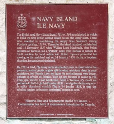
De 1761 à 1764, l'île Navy servit de chantier pour la construction des premiers navires pontés anglais qui devaient maintenir dans la zone supérieure des Grand Lacs les lignes de ravitaillement vers l'ouest pendant la révolte de Pontiac. Rien ne vint troubler le calme de l'île avant que William Lyon Mackenzie, défait à Toronto, n'y menât ses patriotes de Buffalo, le 14 décembre 1837. Les réguliers britanniques et la milice bloquèrent aussitôt l'île; le 14 janvier 1838, le chef des rebelles, jugeant la situation désespérée, quittait les lieux.
Erected
this page online
Topics and series. This historical marker is listed in these topic lists: Colonial Era • Wars, US Indian. In addition, it is included in the Canada, Historic Sites and Monuments Board series list. A significant historical date for this entry is January 14, 1838.
Location. 43° 2.645′ N, 79° 1.058′ W. Marker is in Niagara Falls, Ontario, in Niagara Region. It is in Chippawa. It is on Niagara River Parkway north of Willick Road, on the left when traveling south. This historic marker is located on the Canadian side of the Niagara River, a short distance south of Niagara Falls, Ontario, and opposite Navy Island, just south of the Chippawa Battlefield Park. Touch for map. Marker is in this post office area: Niagara Falls ON L2E 6S6, Canada. Touch for directions.

Regionally, this marker is on Ontario’s Golden Horseshoe and in Niagara Canada. It is also in Central Canada. Globally, it is in North America, on the Great Lakes, in the Western Hemisphere, in the Western World, and in the Anglosphere. Historically, it finds itself in what was once a British colony, the Viceroyalty of
Photographed by Dale K. Benington, July 28, 2011
2. Navy Island Marker
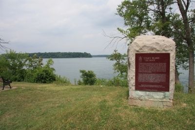
View of the historical marker with the Niagara River in the background and the southern tip of Navy Island in the distant background.
Other nearby markers. At least 8 other markers are within walking distance of this marker: Ussher's Creek Bridge (approx. 0.8 kilometers away); The Battle of Chippawa (approx. one kilometer away); a different marker also named Battle of Chippawa (approx. 1.1 kilometers away); a different marker also named The Battle of Chippawa (approx. 1.1 kilometers away); Chippawa Battlefield Panel 6 (approx. 1.1 kilometers away); Chippawa Battlefield Panel 5 (approx. 1.1 kilometers away); Chippawa Battlefield Panel 4 (approx. 1.1 kilometers away); Chippawa Battlefield Panel 2 (approx. 1.1 kilometers away). Touch for a list and map of all markers in Niagara Falls.
Also see . . . Navy Island. This is a link to information provided by Wikipedia, the free encyclopedia. (Submitted on November 5, 2011, by Dale K. Benington of Toledo, Ohio.)
Photographed by Dale K. Benington, July 28, 2011
3. Navy Island Marker
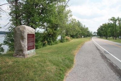
View of the historic marker looking south along the Niagara Parkway.
Photographed by Kevin Westell, July 3, 2025
4. Navy Island
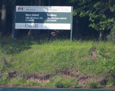
Navy Island is now owned by Parks Canada, unoccupied with no public access. There is a dock at the south (upstream) end. It has a large deer population and a few paw-paw trees.
Credits. This page was last revised on February 25, 2026. It was originally submitted on November 1, 2011, by Dale K. Benington of Toledo, Ohio. This page has been viewed 840 times since then and 28 times this year. Photos: 1, 2, 3. submitted on November 5, 2011, by Dale K. Benington of Toledo, Ohio. 4. submitted on July 6, 2025, by Kevin Westell of St. Catharines, Ontario.
