Near Chippawa in Niagara Region, Ontario — Central Canada (North America)
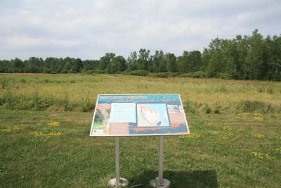
Chippawa Battlefield Panel 2
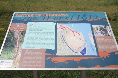
Opening Strikes
— July 5, 1814 3:00 p.m. —
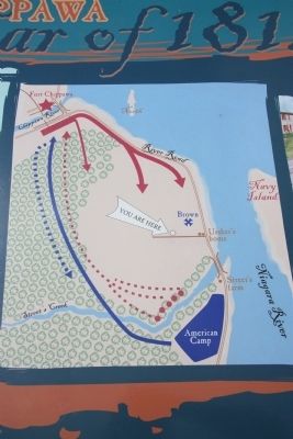
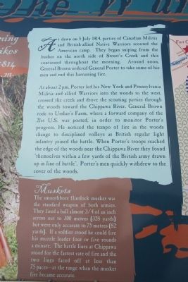
At about 2pm, Porter led his New York and Pennsylvania Militia and allied Warriors into the woods to the west, crossed the creek and drove the scouting parties through the woods towards the Chippawa River. General Brown rode to Ussher's Farm, where a forward company of the 21st U.S. was posted, in order to monitor Porter's progress. He noticed the tempo of fire in the woods change to disciplined volleys as British regular light infantry joined the battle. When Porter's troops reached the edge of the woods near the Chippawa River they found themselves within a few yards of the British army drawn up in the line of battle. Porter's men quickly withdrew to the cover of the woods.
Muskets
The smoothbore flintlock musket was the standard weapon of both armies. They fired a ball almost 3/4 of an inch across out to 300 meters (328 yards) but were only accurate to 75 meters (82 yards). If a soldier stood he could fire his muzzle loader four or five rounds a minute. The battle lines at Chippawa stood for the fastest rate of fire and the two lines faced off at less than 75 paces at the range when the musket fire becomes accurate.
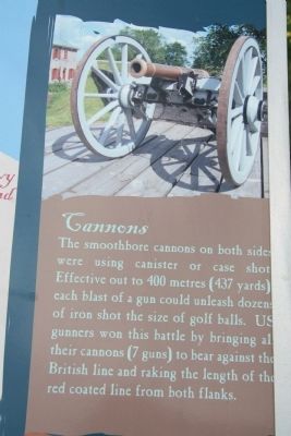
Cannons
The smoothbore cannons on both sides were using canister or case shot. Effective out to 400 meters (437 yards) each blast of a gun could unleash dozens of iron shot the size of golf balls. U.S. gunners won this battle by bringing their cannons (7 guns) against the British line and raking the length of the red coated line from both flanks.
Erected 2001 by The Niagara Parks Commission.
Topics. This historical marker is listed in these topic lists: Colonial Era • Native Americans • War of 1812. A significant historical date for this entry is July 5, 1814.
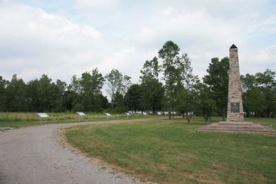
Location. 43° 3.138′ N, 79° 1.485′ W. Marker is near Chippawa, Ontario, in Niagara Region. Marker can be reached from Niagara River Parkway just west of Edgworth Road, on the right when traveling south. This historical marker is located on the Canadian side of the Niagara River, a short distance south of Chippawa, Ontario, and opposite Navy Island, in the Chippawa Battlefield Park. This historical marker is part of the Chippawa Battlefield Park Walking Tour - and is one of six Plexiglass panels, that is freestanding in a row along the northern boundary of the park, approximately 15 yards
from the Chippawa Battlefield Monument. Touch for map. Marker is in this post office area: Chippawa ON L2E 6S6, Canada. Touch for directions.
Other nearby markers. At least 8 other markers are within walking distance of this marker. Chippawa Battlefield Panel 3 (here, next to this marker); Chippawa Battlefield Panel 1 (here, next to this marker); Chippawa Battlefield Panel 4 (a few steps from this marker); Battle of Chippawa (a few steps from this marker); Chippawa Battlefield Panel 5 (a few steps from this marker); Chippawa Battlefield Panel 6 (within shouting distance of this marker); a different marker also named The Battle of Chippawa (about 90 meters away, measured in a direct line); a different marker also named The Battle of Chippawa (about 150 meters away). Touch for a list and map of all markers in Chippawa.
Related markers. Click here for a list of markers that are related to this marker. To better understand the relationship, study each marker in the order shown.
Credits. This page was last revised on September 27, 2019. It was originally submitted on November 11, 2011, by Dale K. Benington of Toledo, Ohio. This page has been viewed 711 times since then and 10 times this year. Photos: 1, 2, 3. submitted on November 12, 2011, by Dale K. Benington of Toledo, Ohio. 4, 5, 6. submitted on November 13, 2011, by Dale K. Benington of Toledo, Ohio.
