The National Mall in Southwest Washington in Washington, District of Columbia — The American Northeast (Mid-Atlantic)
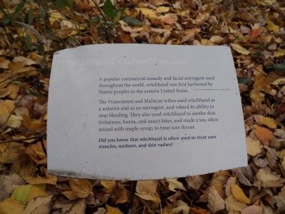
Witchhazel • Suhwe?t (suh-whet)
A popular commercial remedy and facial astringent used throughout the world, witchhazel was first harvested by Native peoples in the eastern United States.
The Potawatomi and Mahican tribes used witchhazel as a sedative and as an astringent, and valued its ability to stop bleeding. They also used witchhazel to soothe skin irritations, burns, and insect bites, and made a tea, often mixed with maple syrup, to treat sore throat.
Did you know that witchhazel is often used to treat sore muscles, sunburn, and skin rashes?
Topics. This historical marker is listed in these topic lists: Native Americans • Science & Medicine.
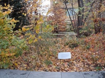
Location. Marker has been permanently removed. It was located near 38° 53.322′ N, 77° 0.955′ W. Marker was in Southwest Washington in Washington, District of Columbia. It was in The National Mall. Marker was on Jefferson Drive Southwest east of 3rd Street Southwest, on the right when traveling east. Marker is located on the north side of the National Museum of the American Indian. Touch for map. Marker was in this post office area: Washington DC 20565, United States of America.
We have been informed that this sign or monument is no longer there and will not be replaced. This page is an archival view of what was.
Other nearby markers. At least 8 other markers are within walking distance of this location. George Rivera (a few steps from this marker); National Native American Veterans Memorial (within shouting distance of this marker); Cardinal Direction Marker: North (within shouting distance of this marker); Cardinal Direction Marker: East (within shouting distance of this marker); Traditional Croplands (about 300 feet away, measured in a direct line); Cardinal Direction Marker: South (about 300 feet away); Rick Bartow (about 300 feet away); Nora Naranjo-Morse (about 400 feet away). Touch for a list and map of all markers in Southwest Washington.
Credits. This page was last revised on January 30, 2023. It was originally submitted on November 19, 2011, by Bill Coughlin of Woodland Park, New Jersey. This page has been viewed 499 times since then and 5 times this year. Photos: 1, 2. submitted on November 19, 2011, by Bill Coughlin of Woodland Park, New Jersey.

