Sandy Hook in Washington County, Maryland — The American Northeast (Mid-Atlantic)
Lift Lock 33
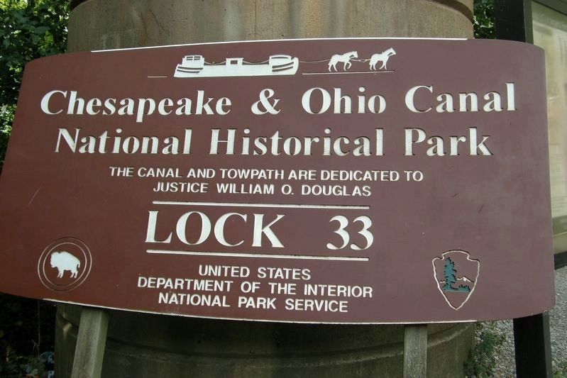
Chesapeake and Ohio National Historical Park
— National Park Service, U.S. Department of the Interior —
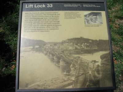
Here, the forces of nature created a natural corridor for commerce. The Shenandoah and Potomac Rivers carved a notch in the mountains, providing passage west. Communities grew up on both sides of the river and later a turnpike, railroad, and canal came through this notch. The railroad and canal competed constantly until the railroad gained dominance. Because of the devastation of the Civil War and decreasing dependence on waterpower the area declined in importance.
Erected by National Park Service, U.S Dept. of the Interior.
Topics and series. This historical marker is listed in these topic lists: Railroads & Streetcars • Roads & Vehicles • War, US Civil • Waterways & Vessels. In addition, it is included in the Chesapeake and Ohio (C&O) Canal series list.
Location. 39° 19.436′ N, 77° 43.564′ W. Marker is in Sandy Hook, Maryland, in Washington County. Marker is on Sandy Hook Road, on the right when traveling east. Located along the C&O Canal towpath, close to the foot and railroad bridge across the Potomac to Harpers Ferry. Touch for map. Marker is in this post office area: Knoxville MD 21758, United States of America. Touch for directions.
Other nearby markers. At least 8 other markers are within walking distance of this marker. Harpers Ferry - Changes through Time (about 600 feet away, measured in a direct line); The Point (about 800 feet away in West Virginia); Where Three National Trails Meet (approx. 0.2 miles away in West Virginia); The Iron Horse Wins (approx. 0.2 miles away in West Virginia); Early Travel (approx. 0.2 miles away in West Virginia); The Race to the Ohio (approx. 0.2 miles away in West Virginia); The Mule Falters (approx. 0.2 miles away in West Virginia); Capture of Harpers Ferry (approx. 0.2 miles away in West Virginia).
More about this marker. The background of the marker is a photo of the confluence of the Potomac and Shenandoah Rivers at Harpers Ferry. "Today the confluence of two national historic parks - Chesapeake and Ohio Canal and Harpers Ferry - offer glimpses of an enterprising past. Take time to explore both parks." An inset photo of a canal boat is captioned, "The Lock 33 area once supported a bustling, small community."
Regarding Lift Lock 33. This marker is one of a set along the National Park Service's trail to the top of Maryland Heights.
Also see . . . Chesapeake and Ohio Canal
Photographed By Craig Swain, August 12, 2007
2. Railroad Bridge over the C&O Canal
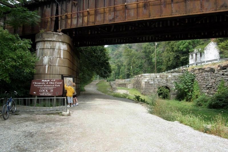
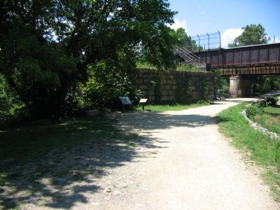
The marker stands at near the railroad bridge, which also supports the foot bridge across the Potomac. The structure behind the markers is one of the pillars used by older bridges dating to the 19th Century. These older bridges passed between Maryland Heights and the river, making a sharp left turn over the bridge. Later in the 1890s, the railroad was allowed to tunnel through Maryland Heights to produce the present day path, and a less sharp turn for the trains.
Additional commentary.
1. Trail Intersection
Not only do the roads, railroads, and canals seem to converge at this point, but passing the marker are two major hiking trails - the C&O Towpath and the Appalachian Trail. The Appalachian Trail connects to the towpath at the footbridge. The two split back out at Lock 31 near Weverton, where the Appalachian Trail ascends South Mountain.
— Submitted January 26, 2008, by Craig Swain of Leesburg, Virginia.
Photographed By Craig Swain, August 12, 2007
5. Lock 33 and House
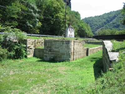
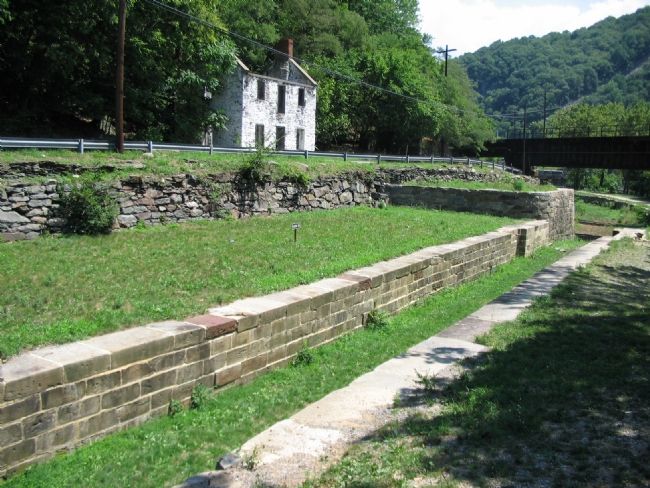
The lock was completed in 1833. The lock itself was constructed from stone hauled over the Potomac from Virginia (flint and granite). The white house is known as Spencer's Store or Elgin House. An adjacent structure, known as the Salty Dog Saloon, which no longer stands, was widely known through the 1930s for serving the less savory flavors.
Photographed By Craig Swain, August 12, 2007
6. The Downstream Side of the Lock and the Railroad Bridge
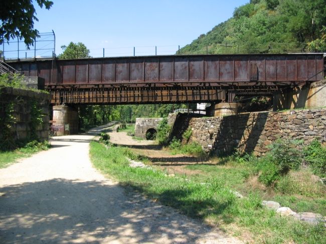
The arched culvert to the right of the canal ditch is the bypass flume. Two railroads pass overhead, the Winchester & Potomac Railroad and the Baltimore & Ohio Railroad. Sandy Hook Road passes above the canal retaining wall on the right, all making this spot of Maryland a transportation bottleneck of sorts.
Historic American Building Survey
7. By Pass Flume and Culvert
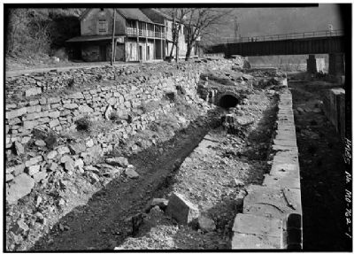
Photo of the lock from 1958. This affords a better view of the flume, culvert, and the lock itself. Compare with photo 3 above. Note also the condition of the house to the left, and what may be the wooden "Salty Dog Saloon" adjoining the white building.
(HABS MD,22-HARF.V,3-1)
(HABS MD,22-HARF.V,3-1)
Photographed By Craig Swain, August 12, 2007
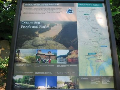
9. Potomac Heritage National Scenic Trail
(Information exhibit next to the marker): You are following a segment of the Potomac Heritage National Scenic Trail, an evolving network that includes the C&O Canal Towpath. An enterprise of many partners, the Trail celebrates the heritage of the Potomac and upper Ohio river basins and offers opportunities for hiking, bicycling, boating, horseback riding, and cross-country skiing.
Photographed By Craig Swain, August 12, 2007
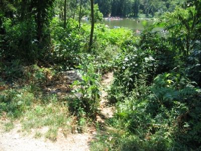
10. Shenandoah River Lock Remains
When first built, a lock was built into the riverside wall of the canal to allow barges to transit across the Potomac. There the barges would service Harpers Ferry. Skirting canals up the Shenandoah River promised to bring the goods down the great valley. However, with the arrival of the railroads, the river lock was used less than anticipated. After floods in the 1880s, the lock was cannibalized and replaced by a retaining wall along the river. The few visible remains of the old river lock are just downstream from the marker.
Credits. This page was last revised on March 19, 2022. It was originally submitted on January 26, 2008, by Craig Swain of Leesburg, Virginia. This page has been viewed 3,395 times since then and 32 times this year. Photos: 1, 2. submitted on January 26, 2008, by Craig Swain of Leesburg, Virginia. 3, 4. submitted on April 26, 2020, by Larry Gertner of New York, New York. 5, 6. submitted on January 26, 2008, by Craig Swain of Leesburg, Virginia. 7. submitted on January 27, 2008, by Craig Swain of Leesburg, Virginia. 8, 9, 10. submitted on January 26, 2008, by Craig Swain of Leesburg, Virginia.
