Near Beaver in Beaver County, Pennsylvania — The American Northeast (Mid-Atlantic)
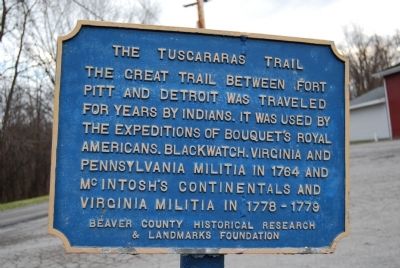
The Tuscararas Trail
Erected by Beaver County Historical Research and Landmarks Foundation.
Topics and series. This historical marker is listed in these topic lists: Native Americans • Roads & Vehicles. In addition, it is included in the Pennsylvania - Beaver County Historical Research and Landmarks Foundation series list. A significant historical year for this entry is 1764.
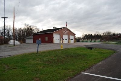
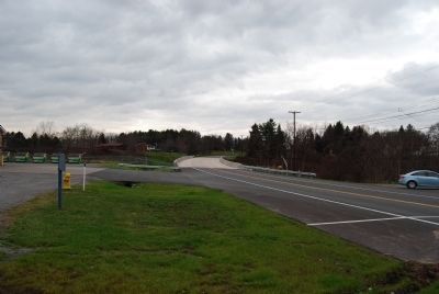
Location. 40° 41.834′ N, 80° 21.587′ W. Marker is near Beaver, Pennsylvania, in Beaver County. Marker is at the intersection of Tuscarawas Road and Cooper Drive, on the right when traveling east on Tuscarawas Road. Located at Brighton Township Volunteer Fire Department #2 Station. Touch for map. Marker is in this post office area: Beaver PA 15009, United States of America. Touch for directions.
Other nearby markers. At least 8 other markers are within 3 miles of this marker, measured as the crow flies. Brighton Township Veterans Memorial (approx. 0.9 miles away); Richmond Little Red Schoolhouse (approx. 1.3 miles away); Agnew Square (approx. 2.7 miles away); McIntosh Square (approx. 2.7 miles away); Beaver County Civil War Memorial (approx. 2.7 miles away); Native American Site 36BV9 (approx. 2.7 miles away); Beaver County Korean War Memorial (approx. 2.8 miles away); Brigadier General William Irvine (approx. 2.8 miles away). Touch for a list and map of all markers in Beaver.
Also see . . . Beaver County Historical Research and Landmarks Foundation. Foundation website homepage (Submitted on December 4, 2011, by Mike Wintermantel of Pittsburgh, Pennsylvania.)
Credits. This page was last revised on August 7, 2022. It was originally submitted on December 4, 2011, by Mike Wintermantel of Pittsburgh, Pennsylvania. This page has been viewed 933 times since then and 54 times this year. Photos: 1, 2, 3. submitted on December 4, 2011, by Mike Wintermantel of Pittsburgh, Pennsylvania.


