Shawnee in Johnson County, Kansas — The American Midwest (Upper Plains)
California Road
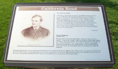
The California Road
Originally a trail through the lands of the Shawnee Indians, running west from Westport through present day Johnson and Douglas Counties, this route was used throughout the 1830's and 1840's by Indians, missionaries, and surveyors. John C. Fremont led one of his famous expeditions to the west down this road. By the mid 1850's the road was known locally as the Westport to Lawrence Road. But from 1856 to the eve of the Civil War in 1860, it was best known as the California Road, as the perils of the local border guerrilla warfare near southern Johnson County drove emigrant traffic north to this route, which connected to the Oregon-California trail proper near Lawrence.
©KCAHTA 2005
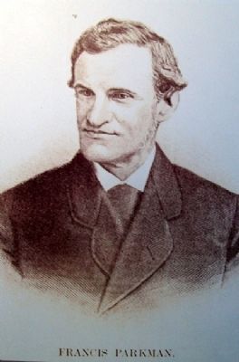
Francis Parkman
Spring 1846
"We were free of the woods and bushes, and fairly upon the broad prairie...At noon we stopped to rest not far from a little creek, replete with frogs and young turtles...The horses were turned to feed among the scattered bushes of a low, oozy meadow. A drowsy springlike sultriness pervaded the air, and the voices of ten thousand young frogs and insects, just awakened into life, rose from the creek and meadows."
Parkman had traveled on what would later be known as the California Road out of Westport to this location near present day 61st and Knox at Turkey Creek, before continuing on northwest on the Fort Leavenworth Military Road to Fort Leavenworth, and then on into the west on the famous trip that would result in Francis Parkman's classic book, The Oregon Trail.
Erected 2006 by City of Shawnee and State Historical Society of Missouri.
Topics and series. This historical marker is listed in these topic lists: Communications • Environment • Exploration • Roads & Vehicles. In addition, it is included in the California Trail series list. A significant historical year for this entry is 1856.
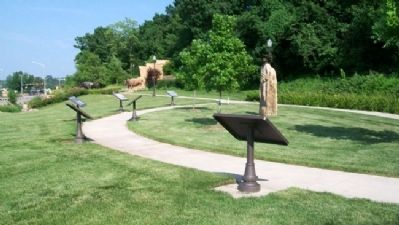
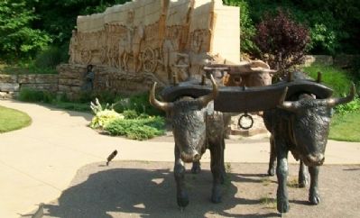
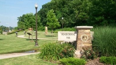
Location. 39° 0.863′ N, 94° 42.419′ W. Marker is in Shawnee, Kansas, in Johnson County. Marker is on Shawnee Mission Parkway near Melrose Lane, on the right when traveling east. Marker is in Pioneer Crossing Park. Touch for map. Marker is at or near this postal address: 10401 Shawnee Mission Parkway, Shawnee KS 66203, United States of America. Touch for directions.
Other nearby markers. At least 8 other markers are within walking distance of this marker. Fort Leavenworth Military Road (here, next to this marker); Wagonmaster's House (a few steps from this marker); The Development of the Kansas City area Frontier Trails Network (a few steps from this marker); Gum Springs (a few steps from this marker); Westport - Santa Fe Trail - Oregon / California Trail (within shouting distance of this marker); Shawnee Friends Mission (approx. half a mile away); Quantrill's Raid on Shawneetown (approx. ľ mile away); Campbell Home (approx. 0.8 miles away). Touch for a list and map of all markers in Shawnee.
Also see . . .
1. History of Shawnee, Kansas. Shawnee Town Museum website entry (Submitted on December 17, 2011, by William Fischer, Jr. of Scranton, Pennsylvania.)
2. Pioneer Crossing Park, Shawnee, Kansas. Kansas Travel & Tourism website entry (Submitted on December 17, 2011, by William Fischer, Jr. of Scranton, Pennsylvania.)
3. Francis Parkman. Wikipedia entry (Submitted on January 8, 2022, by Larry Gertner of New York, New York.)
4. The Oregon Trail, by Francis Parkman. Entire book at unknown website (Submitted on December 17, 2011, by William Fischer, Jr. of Scranton, Pennsylvania.)
5. Oregon-California Trails Association. Association website homepage (Submitted on December 17, 2011, by William Fischer, Jr. of Scranton, Pennsylvania.)
Credits. This page was last revised on January 8, 2022. It was originally submitted on December 17, 2011, by William Fischer, Jr. of Scranton, Pennsylvania. This page has been viewed 973 times since then and 70 times this year. Photos: 1, 2, 3, 4, 5. submitted on December 17, 2011, by William Fischer, Jr. of Scranton, Pennsylvania.
