Near Blythe in Riverside County, California — The American West (Pacific Coastal)
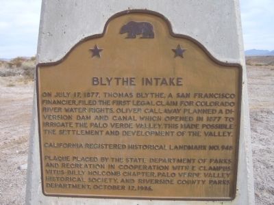
Blythe Intake
Erected 1986 by The State Department of Parks and Recreation in cooperation with E Clampus Vitus – Billy Holcomb Chapter, Palo Verde Valley Historical Society, and Riverside County Parks Department. (Marker Number 948.)
Topics and series. This historical marker is listed in these topic lists: Agriculture • Waterways & Vessels. In addition, it is included in the California Historical Landmarks, and the E Clampus Vitus series lists. A significant historical month for this entry is July 1846.
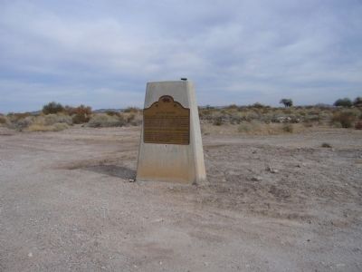
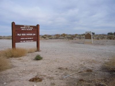
Location. 33° 43.907′ N, 114° 30.948′ W. Marker is near Blythe, California, in Riverside County. Marker is on U.S. 95 at milepost 10.5, on the right when traveling north. The monument is located by the dirt maintenance road leading to the actual canal intake east of the highway. The good maintenance road goes out near the diversion gates and they can be viewed safely. Touch for map. Marker is in this post office area: Blythe CA 92225, United States of America. Touch for directions.
Other nearby markers. At least 7 other markers are within 14 miles of this marker , measured as the crow flies. Palo Verde Irrigation District Diversion Dam (approx. 0.2 miles away); In Memory of Hualapai Ancestors (approx. 4.3 miles away in Arizona); Giant Desert Figures (approx. 4.8 miles away); Desert Strike (approx. 8.4 miles away); Pioneer Cemetery (approx. 8.7 miles away in Arizona); Ehrenberg Cemetery (approx. 8.8 miles away in Arizona); 390th Bomb Group (H) (approx. 13.9 miles away).
More about this marker. The Blythe Intake, among the first attempts to tame the Colorado River, predated by several decades the series of sophisticated dams now found along the waterway. The legally filed claim to the Colorado River became invaluable in 1931 when the Palo Verde Irrigation District was awarded first priority of the seven parties claiming the various Colorado River waters controlled by the newly built Hoover Dam. SOURCE: Billy Holcomb Chapter 1069 35th Anniversary Plaque Book by Phillip Holdaway
Regarding Blythe Intake. This site was designated as California Registered Historical Landmark No.948 on March 1, 1982.
The city of Blythe was named for English developer/financier Thomas Blythe, who first came here in 1877 and established primary water rights on the Colorado River. Blythe came to California hoping to turn the Colorado River Valley into another Nile River Valley. For the most part, he succeeded. Modern irrigation methods have allowed the desert to become a rich farming and recreational area.
Six miles north of Blythe is the site of the original Blythe Intake, where the first legal claim for Colorado River Water was made. Water was transported from here to the nearby Palo Verde Valley which is now lush farmland.
Credits. This page was last revised on June 16, 2016. It was originally submitted on January 3, 2011, by Bill Kirchner of Tucson, Arizona. This page has been viewed 1,512 times since then and 50 times this year. Last updated on December 18, 2011, by Michael Kindig of Elk Grove, California. Photos: 1, 2, 3. submitted on January 3, 2011, by Bill Kirchner of Tucson, Arizona. • Syd Whittle was the editor who published this page.


