Shawnee in Johnson County, Kansas — The American Midwest (Upper Plains)
Gum Springs
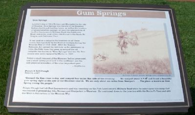
Located today at 59th Terrace and Bluejacket in the city of Shawnee, Gum Springs was the site of the Shawnee Indian church and meeting house, as well as the location of several excellent springs, all near the intersection of the Fort Leavenworth Military Road, the California Road, and at the start of the cutoff road to the Santa Fe, Oregon, and California Trail[s].
It was used as a campsite for travelers on all these routes, but especially by the frontier military during the Mexican War of 1846-1848. After the Kansas/Nebraska Act opened the territory up for settlement in 1854, the little town that grew up around the old campsite was known as "Gum Springs" and was the first county seat until replaced by Olathe in 1857.
Today a small remnant of the Shawnee Indian graveyard, and a small spring pond just to the northeast, are the only physical reminders of the sites' [sic] important past.
©KCAHTA 2005
Private E.N.O. Clough
June 23, 1847
"Crossed the Kaw river to-day, and camped four miles this side of the crossing....We camped about 3 P.M. and found a beautiful gum spring right at the side of the Shawnee church. We are only about six miles from Westport....The place is known as Gum Spring among the people.
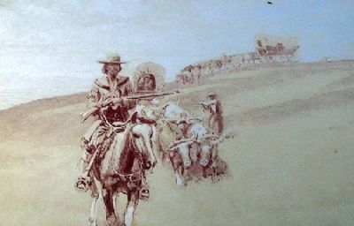
Private Clough had left Fort Leavenworth and was traveling on the Fort Leavenworth Military Road when he came upon this camp that was located at present day 59th Terrace and Bluejacket in Shawnee. He continued down to the junction with the Santa Fe Trail and into the West in this action in the Mexican War.
Erected 2006 by City of Shawnee and State Historical Society of Missouri.
Topics and series. This historical marker is listed in these topic lists: Environment • Roads & Vehicles • Settlements & Settlers • War, Mexican-American. In addition, it is included in the California Trail, the Oregon Trail, and the Santa Fe Trail series lists. A significant historical month for this entry is June 1830.
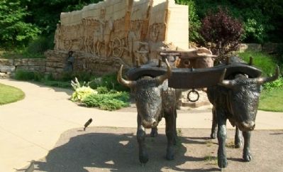
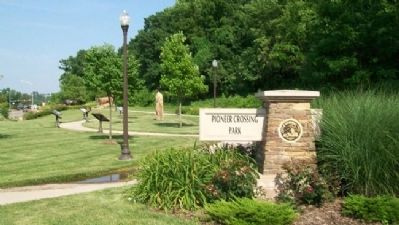
Location. 39° 0.864′ N, 94° 42.405′ W. Marker is in Shawnee, Kansas, in Johnson County. Marker is on Shawnee Mission Parkway near Melrose Lane, on the right when traveling east. Marker is in Pioneer Crossing Park. Touch for map. Marker is at or near this postal address: 10401 Shawnee Mission Parkway, Shawnee KS 66203, United States of America. Touch for directions.
Other nearby markers. At least 8 other markers are within walking distance of this marker. Wagonmaster's House (here, next to this marker); The Development of the Kansas City area Frontier Trails Network (here, next to this marker); Westport - Santa Fe Trail - Oregon / California Trail (here, next to this marker); Fort Leavenworth Military Road (a few steps from this marker); California Road (a few steps from this marker); Shawnee Friends Mission (approx. 0.4 miles away); Quantrill's Raid on Shawneetown (approx. ľ mile away); Campbell Home (approx. 0.8 miles away). Touch for a list and map of all markers in Shawnee.
Also see . . .
1. Santa Fe National Historic Trail. (Submitted on December 19, 2011, by William Fischer, Jr. of Scranton, Pennsylvania.)
2. Oregon National Historic Trail. (Submitted on December 19, 2011, by William Fischer, Jr. of Scranton, Pennsylvania.)
3. California National Historic Trail. (Submitted on December 19, 2011, by William Fischer, Jr. of Scranton, Pennsylvania.)
4. Pioneer Crossing Park, Shawnee KS. (Submitted on December 19, 2011, by William Fischer, Jr. of Scranton, Pennsylvania.)
Credits. This page was last revised on June 16, 2016. It was originally submitted on December 18, 2011, by William Fischer, Jr. of Scranton, Pennsylvania. This page has been viewed 1,497 times since then and 155 times this year. Photos: 1. submitted on December 19, 2011, by William Fischer, Jr. of Scranton, Pennsylvania. 2, 3. submitted on December 17, 2011, by William Fischer, Jr. of Scranton, Pennsylvania. 4. submitted on December 19, 2011, by William Fischer, Jr. of Scranton, Pennsylvania. 5, 6. submitted on December 17, 2011, by William Fischer, Jr. of Scranton, Pennsylvania.
