Pendleton in Anderson County, South Carolina — The American South (South Atlantic)
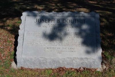
Joseph B. Douthit
A National Leader in Soil and Water Conservation
| — | 1893 — 1972 | — |
Photographed by Brian Scott, January 30, 2012
1. Joseph B. Douthit Marker
Life member Methodist Rural Fellowship.
Commissioner Upper Savannah, Anderson, and Pickens Soil and Water Conservation Districts, 1937-1972, President, S.C. Association of Conservation Districts, 1946-1946, Chairman, S.C. Land Resources Commission, 1951-1956, and Director, National Association of Conservation Districts, 1956-1957.
A Keeper of the Land
Erected 1980 by South Carolina Conservation Districts.
Topics. This historical marker is listed in these topic lists: Education • Environment • Religion & Religious Structures • Waterways & Vessels. A significant historical date for this entry is January 30, 1988.
Location. 34° 37.3′ N, 82° 43.55′ W. Marker is in Pendleton, South Carolina, in Anderson County. It is at the intersection of Lebanon Road and Autun Road, on the right when traveling north on Lebanon Road. Touch for map.
this page online

Regionally, this marker is in Upstate and in the Greater Greenville-Spartanburg Area. It is also in the American South and specifically in the Deep South. Globally, it is in North America, the Western Hemisphere, the Western World, and the Anglosphere. Historically, it finds itself in what was once the territory of the Mississippian Culture, one of the original Thirteen Colonies, one of the Confederate States of America, and the Antebellum South.
Other nearby markers. At least 10 other markers are within 4 miles of this marker, measured as the crow flies: Richard W. Simpson (approx. 1.9 miles away); Sandy Springs Camp Ground / Confederate Muster Ground (approx. 2 miles away); Lebanon Baptist Church (approx. 2.1 miles away); Tanglewood Mansion (approx. 3.6 miles away); Thomas Green Clemson (approx. 3.6 miles away); Barnard Elliott Bee (approx. 3.6 miles away); Clement Hoffman Stevens (approx. 3.6 miles away); a different marker also named Thomas Green Clemson (approx. 3.6 miles away); Printer John Miller (approx. 3.8
Photographed by Brian Scott, January 30, 2012
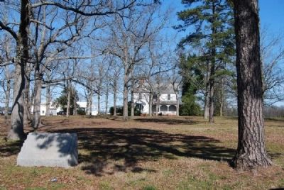
2. Joseph B. Douthit Marker and House
Photographed by Brian Scott, January 30, 2012
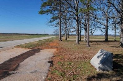
3. Joseph B. Douthit Marker
Looking West Along Lebanon Road
Looking West Along Lebanon Road
Credits. This page was last revised on November 26, 2020. It was originally submitted on January 30, 2012, by Brian Scott of Anderson, South Carolina. This page has been viewed 1,293 times since then and 89 times this year. Photos: 1, 2, 3. submitted on January 30, 2012, by Brian Scott of Anderson, South Carolina.
