Rockland in Knox County, Maine — The American Northeast (New England)
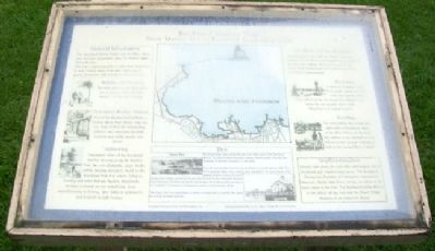
Rockland Harbor Trail
Snow Marine Park to Rockland Breakwater Light
[Historical Excerpt Transcribed]
General Information
The Rockland Harbor Trail is easy to follow. Allow you and your imagination enjoy the Harbor sights along the way. The trail is approximately 5.5. mile[s] from beginning to end, linking many of the city's open spaces, parks, downtown and waterfront historical sites.
Then
The Harbor Park area possesses one of the best views of the Rockland Harbor. The park contains the public landing, Harbormaster office and the Rockland-Thomaston Chamber of Commerce.
The park was transformed from the city dump to a public park in 1935. The W.P.A. provided labor and materials were donated for seawall and the landing. The steel bridge which makes up part of the pier was donated by the Rockland-Rockport Lime Company. The Rockland Yacht club donated the building which serves as the Chamber of Commerce headquarters and the Harbormaster office.
The Harbor Park is a great place to come and relax and is currently the scene for multiple summer festivals.
Information provided by the Shore Village Historical Society.
Topics and series. This historical marker is listed in these topic lists: Charity & Public Work • Communications • Parks & Recreational Areas • Waterways & Vessels. In addition, it is included in the Lighthouses, and the Works Progress Administration (WPA) projects series lists. A significant historical year for this entry is 1935.
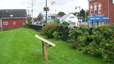
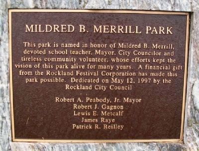
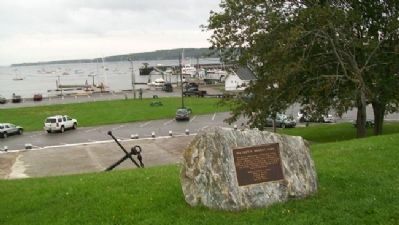
Location. 44° 6.072′ N, 69° 6.537′ W. Marker is in Rockland, Maine, in Knox County. Marker is on Main Street (Maine Route 73) near Myrtle Street, on the right when traveling north. Marker is in Mildred B. Merrill Harbor Park. Touch for map. Marker is at or near this postal address: 252 Main Street, Rockland ME 04841, United States of America. Touch for directions.
Other nearby markers. At least 8 other markers are within walking distance of this marker. Civil War and Edwin Libby Post No. 16, G.A.R. Memorial (about 300 feet away, measured in a direct line); Chapman Park (about 300 feet away); Portland Head Light Bell (1942) (about 400 feet away); The Blues Trail: Mississippi to Maine (about 500 feet away); Strand Theatre (about 700 feet away); World Wars Memorial (approx. 0.3 miles away); Walter Hamor Piston (approx. 0.3 miles away); Spanish American War Memorial (approx. 0.6 miles away). Touch for a list and map of all markers in Rockland.
Also see . . .
1. Rockland (formerly South Village) Historical Society
. (Submitted on February 7, 2012, by William Fischer, Jr. of Scranton, Pennsylvania.)
2. Historic Downtown Rockland, Maine. (Submitted on February 7, 2012, by William Fischer, Jr. of Scranton, Pennsylvania.)
Credits. This page was last revised on October 31, 2020. It was originally submitted on February 7, 2012, by William Fischer, Jr. of Scranton, Pennsylvania. This page has been viewed 1,746 times since then and 7 times this year. Photos: 1, 2, 3, 4, 5. submitted on February 7, 2012, by William Fischer, Jr. of Scranton, Pennsylvania.
