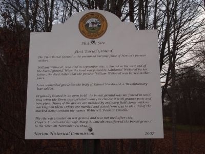
First Burial Ground
William Witherell, who died in September 1691, is buried in the West end of the burial ground. When the land was passed to Nathaniel Witherell by his father,the deed stated that the pioneer William Witherell was buried in that place.
In an unmarked grave lies the body of Daniel Woodward, a Revolutionary War soldier.
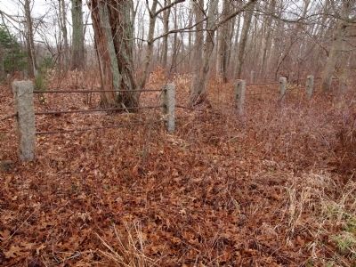
Originally located in an open field,the burial ground was not fenced in until 1894 when the town appropriated money to enclose it with granite posts and iron pipes. Many of the graves are marked by ordinary field stones with no markings on them. Others are marked and dated from 1759 to 1822. All of the marked stones contain the names Weterell, Dean or Lincoln.
The site was situated on wet ground and was not used after 1822. Lloyd S. Lincoln and his wife Mary A. Lincoln transferred the burial ground to the Town on November 29, 1894
Erected 2007 by Norton Historical Commission.
Topics. This historical marker is listed in these topic lists: Cemeteries & Burial Sites • Colonial Era • War, French and Indian • War, US Revolutionary. A significant historical month for this entry is September 1691.
Location. 41° 58.184′ N, 71° 7.579′
Other nearby markers. At least 8 other markers are within 5 miles of this marker, measured as the crow flies. The Site of the First House in Norton (here, next to this marker); Winneccunnett Pond Area (a few steps from this marker); King Philip's Cave (approx. ¾ mile away); The Old Bay Road (approx. 2.4 miles away); Site of First Church in Norton (approx. 3.2 miles away); Norton Common Burial Ground (approx. 4.3 miles away); Winslow and Hopkins (approx. 4.9 miles away); Bristol County Peace Monument (approx. 4.9 miles away). Touch for a list and map of all markers in Norton.
Credits. This page was last revised on June 16, 2016. It was originally submitted on February 8, 2012, by Bryan Simmons of Attleboro, Massachusetts. This page has been viewed 1,255 times since then and 46 times this year. Photos: 1, 2. submitted on February 8, 2012, by Bryan Simmons of Attleboro, Massachusetts. • Bill Pfingsten was the editor who published this page.

