Niagara-on-the-Lake in Niagara Region, Ontario — Central Canada (North America)
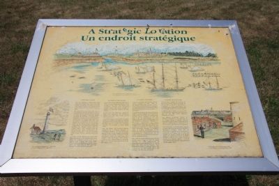
A Strategic Location
You are standing at Mississauga Point where the Niagara River flows into Lake Ontario. Long ago the lakes and rivers were military supply and transportation routes and forts were built to protect them.
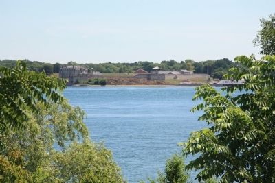
The large stone fort across the river is Fort Niagara. The French built a fort here in 1687, and the present one was begun in 1720. In August 1759 the British captured the fort after a lengthy seige. Prideaux and Johnston streets in Niagara-on-the-Lake are named after the two successful commanders. In 1796, Fort Niagara was turned over to the United States, by the terms of Jay's Treaty. The Niagara River now marked the boundary between the British colony and the United States, and cannons from the American fort easily commanded the mouth of the river. You are standing within range of those cannons from long ago.
As early as 1790 Mississauga Point had been identified as the location for a fort. Plans for a battery of 14 cannons to oppose Fort Niagara date from 1799. Instead, the first lighthouse on the Great Lakes was built here in 1804 and Fort George was built farther upstream.
Fearing that the lighthouse might be filled with explosives, the Americans landed near Two Mile Creek, several miles to the west.
An artillery battery manned by Canadian militia was located near this spot during the battle. It was overwhelmed by cannon fire from two US vessels, the USS Julia, and the USS Growler, at point blank range.
After the battle, the defeated British withdrew to a fortified position at Burlington Heights, and the Americans gained a base on the Niagara Peninsula. Checked at the battles of Stoney Creek, and Beaver Dams, the Americans were unable to take advantage of their victory. US forces were pinned down in Newark, which they burned and abandoned on 10 December, 1813.
Topics. This historical marker is listed in these topic lists: Colonial Era • Forts and Castles • War of 1812. A significant historical month for this entry is May 1813.
Location. 43° 15.697′ N, 79° 4.59′ W. Marker is in Niagara-on-the-Lake, Ontario, in Niagara Region. Marker can be reached from Simcoe Street just north of Front Street. This historical marker is located on the Canadian side of the mouth of the Niagara River, where the river empties into Lake Ontario. It is
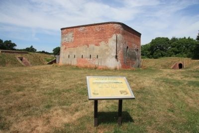
situated along the river on the northern edge of the Niagara-on-the-Lake Golf Course, inside of the earthworks surrounding Fort Mississauga, just to the southeast of the brick fortification that is situated in the center of Fort Mississauga. Touch for map. Marker is in this post office area: Niagara-on-the-Lake ON L0S 1J0, Canada. Touch for directions.
Other nearby markers. At least 8 other markers are within walking distance of this marker. A Fort Evolves (a few steps from this marker); Fort Mississauga (within shouting distance of this marker); Point Mississauga Lighthouse (within shouting distance of this marker); Fort Mississauga is a National Historic Site (within shouting distance of this marker); Fort Mississauga Trail (about 210 meters away, measured in a direct line); The Remains of Three Soldiers (approx. 0.7 kilometers away); The Battle of Fort George (approx. 0.7 kilometers away); Niagara on the Lake Historical District (approx. 0.8 kilometers away). Touch for a list and map of all markers in Niagara-on-the-Lake.
Credits. This page was last revised on September 27, 2019. It was originally submitted on February 14, 2012, by Dale K. Benington of Toledo, Ohio. This page has been viewed 646 times since then and 8 times this year. Photos: 1, 2, 3, 4. submitted on February 14, 2012, by Dale K. Benington of Toledo, Ohio.


