
Pawhuska in Osage County, Oklahoma — The American South (West South Central)
The Battle of Wooster Mound
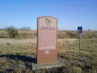
Photographed by Michael Manning, November 28, 2009
1. The Battle of Wooster Mound Marker
Erected by Oklahoma Historical Society.
Topics and series. This historical marker is listed in these topic lists: Law Enforcement • Notable Events. In addition, it is included in the Oklahoma Historical Society series list. A significant historical year for this entry is 1903.
Location. 36° 36.639′ N, 96° 18.283′ W. Marker is in Pawhuska, Oklahoma, in Osage County. It is on State Highway 11/99 ¼ mile north of East Evergreen Street, on the right when traveling north. Touch for map. Marker is in this post office area: Pawhuska OK 74056, United States of America.
this page online

Regionally, this marker is in the Osage Nation and in Greater Tulsa. It is also in the American South, specifically on the prairies, and on the Southern Plains. Globally, it is in North America, the Western Hemisphere, the Western World, and the Anglosphere. Historically, it finds itself in what was once the territory of the Mississippian Culture and also the Louisiana Purchase.
Other nearby markers. At least 8 other markers are within 4 miles of this marker, measured as the crow flies: Pawhuska (approx. 3.8 miles away); a different marker also named Pawhuska (approx. 3.8 miles away); a different marker also named Pawhuska (approx. 3.8 miles away); Veterans Memorial (approx. 3.9 miles away); Osage Buffalo Hunting Trails (approx. 3.9 miles away); Deep Ford (approx. 3.9 miles away); The Swinging Bridge (approx. 3.9 miles away); First Boy Scout Troop in America (approx. 4 miles away). Touch for a list and map of all markers in Pawhuska.
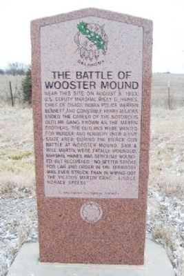
Photographed by William Fischer, Jr., February 23, 2015
2. The Battle of Wooster Mound Marker
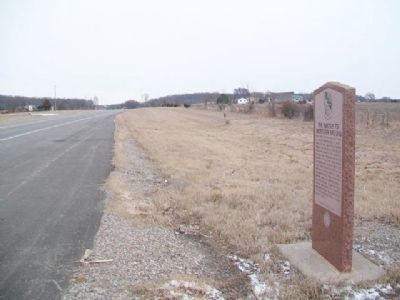
Photographed by William Fischer, Jr., February 23, 2015
3. The Battle of Wooster Mound Marker
Credits. This page was last revised on January 1, 2025. It was originally submitted on February 14, 2012, by Michael Manning of Woodlawn, Tennessee. This page has been viewed 2,956 times since then and 89 times this year. Photos: 1. submitted on February 14, 2012, by Michael Manning of Woodlawn, Tennessee. 2, 3. submitted on March 1, 2015, by William Fischer, Jr. of Reynoldsburg, Ohio. • Bernard Fisher was the editor who published this page.
