Near Gloucester in Gloucester County, Virginia — The American South (Mid-Atlantic)
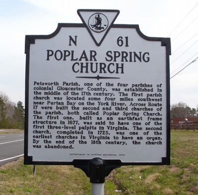
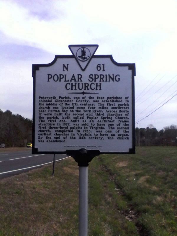
Poplar Spring Church
Erected 2013 by Department of Historic Resources. (Marker Number N-61.)
Topics and series. This historical marker is listed in these topic lists: Cemeteries & Burial Sites • Churches & Religion • Colonial Era • Patriots & Patriotism. In addition, it is included in the Virginia Department of Historic Resources (DHR) series list. A significant historical year for this entry is 1677.
Location. 37° 27.832′ N, 76° 36.276′ W. Marker is near Gloucester, Virginia, in Gloucester County. Marker is on George Washington Memorial Highway (U.S. 17) south of Chesapeake Road, on the right when traveling south. It is on the southbound lanes, just before the turn lane for Petworth Elementary School. Touch for map. Marker is at or near this postal address: 10744 George Washington Memorial Hwy, Gloucester VA 23061, United States of America. Touch for directions.
Other nearby markers. At least 8 other markers are within 5 miles of this marker, measured as the crow flies. A different marker also named Poplar Spring Church (here, next to this marker); Marlfield (approx. 0.9 miles away); Gloucester Hall (approx. 1.7 miles away); The Indentured Servants' Plot (approx. 3.6 miles away); King and Queen County / Gloucester County (approx. 3.6 miles away); Poropotank Creek (approx. 3.6 miles away); Bethel Baptist Church (approx. 3.7 miles away); Indian Princess Pocahontas (approx. 4.9 miles away). Touch for a list and map of all markers in Gloucester.
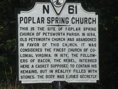
Also see . . . Old Marker at this Location. This marker replaced an older one at this location also titled “Poplar Spring Church” (Submitted on April 9, 2018.)
Additional commentary.
1. Pastor/Rev. Thomas Vicaris 1666-1696
My grrrr-grandfather was Rev. Thomas Vicaris and he was the pastor, rector and over the Vestry at Poplar Springs church from 1666 to 1696. He was born in Gloucester County.
His father's name was Thomas Vicaris, too. He was born in 1633 in York County (his mother was Jonne French born in 1639). The Reverend was an only child.
Rev. Thomas Vicaris's daughter Mary was married to my grandfather Robert Nettles. Robert was born in Gloucester in 1677. He was Gloucester County's surveyor in the 1690s and elected Gloucester County supervisor from 1700 to 1704.
Robert's parents were Captain John Nettles (sea captain) and Mary Reed. They were married at St. Dunstan, Stepney, London on May 18, 1647. Captain John Nettles was born in Portsmouth, UK., Oct.1, 1620. He first arrived in America as a sea captain on March 10, 1651 and was reported "lost at sea" on May 26,1686.
His wife Mary died in New Town(Newton), Massachusetts on October 4,1691.
Robert Nettles had (4) grandsons, which were brothers, that were born in Gloucester County and fought in the American Revolutionary War in South Carolina. The most notable was Captain William Nettles. He fought from July 1776 to Dec. 1782. He was the Kershaw Company CMDR. His regiment was the Pee Dee Regiment. His commanding officer was Gen. Francis Marion (The Swamp Fox). The movie "The Patriot" depicts his Regiment!
Rev. Thomas Vicaris's relatives are thought to have been members of Virginia's "Lost Colony"!
Note: Reverend Thomas Vicaris owned approximately 2,000 acres of land. Much of his land was located on the Chesapeake Bay.
In 1678, he obtained 1,350 acres of the 2,000 acres from land grants for transporting 27 families into Colonial Petsworth Parish.
The city of Falmouth, Virginia was founded and subsists today on the same land that Reverend Vicaris was the first American owner.
The pastor also owned an 87 acre island located at the mouth of the Rappahannock River (Parrot Island).
— Submitted July 31, 2011, by Randy Nettles of Charleston, South Carolina.
Credits. This page was last revised on June 28, 2021. It was originally submitted on October 14, 2007, by Laura Troy of Burke, Virginia. This page has been viewed 3,552 times since then and 93 times this year. Last updated on February 15, 2012, by Randy Nettles of Charleston, South Carolina. Photos: 1. submitted on April 2, 2018, by James Shackelford of Macungie, Pennsylvania. 2. submitted on April 1, 2018, by James Shackelford of Macungie, Pennsylvania. 3. submitted on October 14, 2007, by Laura Troy of Burke, Virginia. • Bill Pfingsten was the editor who published this page.


