Near Lyons in Rice County, Kansas — The American Midwest (Upper Plains)
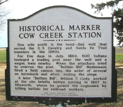
Cow Creek Station
One mile south is the hand-dug well that served the U.S. Cavalry and Santa Fe Trail travelers in the 1860s.
For five days in July, 1864, 600 Indians besieged a trading post near the well and a wagon train nearby. When the attackers tried to overrun the post, "Buffalo Bill" Mathewson fired a field cannon into the midst of several on horseback and afoot, ending the siege.
A later "Buffalo Bill", William F. Cody, worked at the site briefly before moving in 1867 to Ellsworth, where he gained the cognomen by killing buffalo for railroad workers.
Erected by Rice County Historical Society and Rice County Bicentennial Commission.
Topics and series. This historical marker is listed in these topic lists: Native Americans • Settlements & Settlers • Wars, US Indian. In addition, it is included in the Santa Fe Trail series list. A significant historical month for this entry is July 1864.
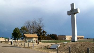
Location. 38° 20.851′ N, 98° 16.566′ W. Marker is near Lyons, Kansas, in Rice County. Marker is on Avenue M (U.S. 56) near 12th Road, on the left when traveling west. Marker is at a roadside rest area about three miles west of Lyons. Touch for map. Marker is in this post office area: Lyons KS 67554, United States of America. Touch for directions.
Other nearby markers. At least 8 other markers are within 10 miles of this marker, measured as the crow flies . Coronado and Quivira (here, next to this marker); Fray Juan de Padilla (within shouting distance of this marker); Rice County Historical Mural (approx. 3.9 miles away); Civil War and Veterans Memorial (approx. 3.9 miles away); Workman Park (approx. 4.1 miles away); Santa Fe Trail (approx. 4.3 miles away); Veterans Memorial (approx. 7.4 miles away); Cooper Hall (approx. 9˝ miles away). Touch for a list and map of all markers in Lyons.
Also see . . .
1. Cow Creek in 1912 Kansas Cyclopedia. KSGenWeb website entry (Submitted on March 8, 2012, by William Fischer, Jr. of Scranton, Pennsylvania.)
2. The Ranch at Cow Creek Crossing. Kansas Historical Society website entry (Submitted on March 8, 2012, by William Fischer, Jr. of Scranton, Pennsylvania.)
3. Santa Fe National Historic Trail. National Park Service website entry (Submitted on March 8, 2012, by William Fischer, Jr. of Scranton, Pennsylvania.)
Credits. This page was last revised on January 30, 2022. It was originally submitted on March 8, 2012, by William Fischer, Jr. of Scranton, Pennsylvania. This page has been viewed 752 times since then and 46 times this year. Photos: 1, 2. submitted on March 8, 2012, by William Fischer, Jr. of Scranton, Pennsylvania.

