Near Aransas Pass in Aransas County, Texas — The American South (West South Central)
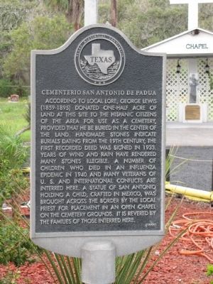
Cementerio San Antonio de Padua
Photographed by Norman Frank, March 20, 2012
1. Cementerio San Antonio de Padua Marker
Erected 1998 by Texas Historical Commission. (Marker Number 11686.)
Topics. This historical marker is listed in these topic lists: Cemeteries & Burial Sites • Hispanic Americans. A significant historical year for this entry is 1933.
Location. 27° 56.215′ N, 97° 7.331′ W. Marker is near Aransas Pass, Texas, in Aransas County. It can be reached from Cemetery Road 0.1 miles west of Business State
this page online

Regionally, this marker is on the American Gulf Coast. Globally, it is in North America, a Gulf of Mexico state, the Western Hemisphere, the Western World, and the Anglosphere. Historically, it finds itself in what was once New Spain, the Republic of Texas, and one of the Confederate States of America.
Other nearby markers. At least 8 other markers are within 6 miles of this marker, measured as the crow flies: John Wiebel VFW Post 2932 (approx. 2½ miles away); VFW (approx. 2½ miles away); Great Land Lottery of Aransas Pass (approx. 2½ miles away); Terminal Railroad (approx. 2.8 miles away); Aransas Pass First Baptist Church (approx. 3 miles away); First United Methodist Church (approx. 3 miles away); Port Bay Hunting and Fishing Club (approx. 5.6 miles away); Eleventh Airborne Memorial (approx. 5.7 miles away). Touch for a list and map of all markers in Aransas Pass.
Photographed by Norman Frank, March 20, 2012
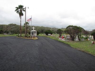
2. Cementerio San Antonio de Padua
Photographed by Norman Frank, March 20, 2012
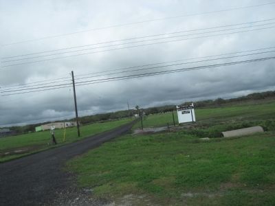
3. Turn from Business Highway 35 onto Cemetery Road
Credits. This page was last revised on June 16, 2016. It was originally submitted on March 20, 2012. This page has been viewed 2,838 times since then and 289 times this year. Photos: 1, 2, 3. submitted on March 20, 2012. • Bernard Fisher was the editor who published this page.
