
Niagara-on-the-Lake in Niagara Region, Ontario — Central Canada (North America)
Niagara Harbour and Dock Company
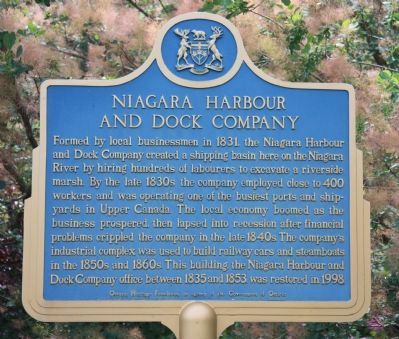
Photographed by Dale K. Benington, July 27, 2011
1. Niagara Harbour and Dock Company Marker
Erected by Ontario Heritage Foundation, an agency of the Government of Ontario.
Topics and series. This historical marker is listed in these topic lists: Colonial Era • Industry & Commerce. In addition, it is included in the Canada, Ontario Heritage Trust series list. A significant historical year for this entry is 1831.
Location. 43° 15.267′ N, 79° 3.824′ W. Marker is in Niagara-on-the-Lake, Ontario, in Niagara Region. It is on Ricardo Street just east
this page online

Regionally, this marker is on Ontario’s Golden Horseshoe and in Niagara Canada. It is also in Central Canada. Globally, it is in North America, on the Great Lakes, in the Western Hemisphere, in the Western World, and in the Anglosphere. Historically, it finds itself in what was once a British colony, the Viceroyalty of New France, the Haudenosaunee (Iroquois) Confederacy, and Rupert’s Land.
Other nearby markers. At least 8 other markers are within walking distance of this marker: Butler's Rangers (about 180 meters away, measured in a direct line); Engine House Historic Site (about 210 meters away); Turntable Historic Site (approx. 0.3 kilometers away); The Fortified Mouth of the Niagara River (approx.

Photographed by Dale K. Benington, July 27, 2011
2. Niagara Harbour and Dock Company Marker
A distant view of the historical marker to the right of the yellow structure which was the company office building.
Other markers no longer nearby. Locomotive Turntable (was approx. 0.3 kilometers away but has been permanently removed); A Strategic Site (was approx. 0.3 kilometers away but has been replaced with another marker now near it); Fort Niagara (was approx. 0.3 kilometers away but has been replaced with another marker now near it).
Photographed by Dale K. Benington, July 27, 2011
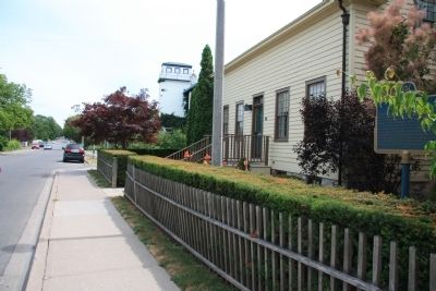
3. Niagara Harbour and Dock Company Marker
View, looking south on Ricardo Street, of both the historical marker in the right foreground, and the yellow office building just beyond the historical marker.
Photographed by Dale K. Benington, July 27, 2011
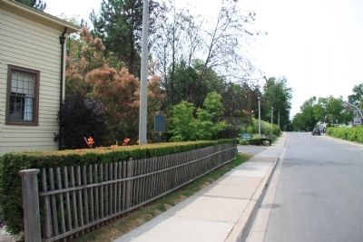
4. Niagara Harbour and Dock Company Marker
View, looking north on Ricardo Street, of the yellow office building and the historical marker.

Photographed by Dale K. Benington, July 27, 2011
5. Niagara Harbour and Dock Company Marker
View of the yellow office building as seen when looking through some of the boats that are tied up in the marina located in front of the building.
Credits. This page was last revised on September 27, 2019. It was originally submitted on April 1, 2012, by Dale K. Benington of Toledo, Ohio. This page has been viewed 1,147 times since then and 43 times this year. Photos: 1, 2, 3, 4, 5. submitted on April 2, 2012, by Dale K. Benington of Toledo, Ohio.
