Near Mettler in Kern County, California — The American West (Pacific Coastal)
Fages-Zalvidea Trails
California Historical Landmark
Photographed by Denise Boose, April 6, 2012
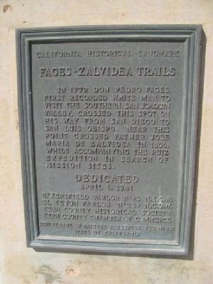
1. Fages-Zalvidea Trails Marker
In 1772, Don Pedro Fages, first recorded non-Indian to visit the southern San Joaquin Valley, crossed this spot on his way from San Diego to San Luis Obispo. Near this point crossed Father José María de Zalvidea in 1806, while accompanying the Ruiz expedition in search of mission sites.
Erected 1941 by Bakersfield Parlor No. 42 N.S.G.W., El Tejon Parlor No239 N.S.G.W., Kern Country Historical Society, Kern Country Chamber of Commerce, Department of Natural Resources, State of California. (Marker Number 291.)
Topics and series. This historical marker is listed in these topic lists: Colonial Era • Exploration • Hispanic Americans • Settlements & Settlers. In addition, it is included in the California Historical Landmarks, and the Native Sons/Daughters of the Golden West series lists. A significant historical year for this entry is 1772.
Location. 35° 3.554′ N, 119° 3.995′ W. Marker is near Mettler, California, in Kern County. It is on Maricopa Highway (State Highway 166) 3.7 miles west of Interstate 5, on the right when traveling west. Touch for map. Marker is in this post office area: Bakersfield CA
this page online

Regionally, this marker is in the San Joaquin Valley, specifically in the Central Valley, and in the Sierra Nevada. It is also on the American Pacific Coast. Globally, it is in North America, on the Ring of Fire, on the Pacific Rim, in the Western Hemisphere, in the Western World, and in the Anglosphere. Historically, it finds itself in what was once New Spain and also Mexico’s Alta California.
Other nearby markers. At least 8 other markers are within 12 miles of this marker, measured as the crow flies: El Pueblo de San Emigdio (approx. 6.1 miles away); Wind Wolves Preserve (approx. 6.7 miles away); Sinks of the Tejon (approx. 8.9 miles away); Rewilding Tule Elk (approx. 9 miles away); El Camino Viejo (approx. 9.4 miles away); Reflection Pond (approx. 9.7 miles away); Jose Dominguez Adobe Site (approx. 10.2 miles away); Rose Station (approx. 11.1 miles away).
Photographed by Denise Boose, April 6, 2012
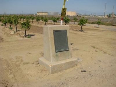
2. Fages-Zalvidea Trails Marker
With the water tanks in the background.
Credits. This page was last revised on October 13, 2024. It was originally submitted on April 10, 2012, by Denise Boose of Tehachapi, California. This page has been viewed 1,715 times since then and 85 times this year. Photos: 1, 2. submitted on April 10, 2012, by Denise Boose of Tehachapi, California. • Syd Whittle was the editor who published this page.
